Saturday, January 03, 2009

Vyara,Tapi District,Gujarat,India


Vyara is a city, a municipality and the district headquarters of the newly created Tapi District of Gujarat State on the Western coast of India.

Friday, January 02, 2009

Vadodara, Gujarat


vadodara 15
Originally uploaded by smit_nid.
Vadodara or better known as Baroda, has a population of 1.7 million people. It is the third biggest town in Gujarat after Ahmedabad and Surat. Vadodara is one of the most cosmopolitan cities in India and therefore is considered the cultural capital of Gujarat.

The city of Vadodara was conquered by Maratha leader, Pilaji Gaekwad, in 1721 from the Mughals. The Peshwa (nominal leader of the Marathas) recognized the Gaekwads rule over Vadodara. After the defeat of Marathas in 1761 by the Afghans, the Gaekwads consolidated their control over Vadodara. In 1802, the British signed a treaty with the Gaekwads and recognized The Maharaja of Baroda.

Thursday, January 01, 2009

Valsad, Gujarat


The city of former Prime Minister of India, Morarji Desai, Valsad is a city located in the southern most part of Gujarat state. Valsad is well known for its Alphonso (Haapus) mangoes and still retains this business as one of the main segments of its economy. The city has a population of 1.4 million people.

Tuesday, February 26, 2008

Ahmedabad, Gujarat


There are more than 3,000 pictures of Ahmedabad on Flickr. This is the closest one that can represent this important city of 5.2 million people. Gujarati food is one of the best vegetarian foods that India offers. It is not easy to find food like this in the entire United States.

Located on the banks of Sabarmati River, Ahmedabad was the capital of Gujarat from 1960 to 1970, till it was moved to Gandhinagar. It is the largest city in Gujarat and the seventh largest city in India.

Monday, February 25, 2008

Amreli, Gujarat


eDSC00039
Originally uploaded by mmtayabali.
Jivaraj Mehta, the first Chief Minister of Gujarat , was from this city. Amreli was part of Baroda state under Gaekwads during the nineteenth century. After independence, the district became part of Bombay State and a separate district in Gujarat State after the bifurcation of Bombay State.

Sunday, February 24, 2008

Cambay (Gulf of Khambhat), Anand District, Gujarat


Kite makers, Cambay
Originally uploaded by Dr Vivek M.
The Gulf of Khambhat (formerly known as the Gulf of Cambay) is an inlet of the Arabian Sea along the west coast of India, in the state of Gujarat.

The Gulf of Khambhat has been an important center of trade since ancient times; its ports connect central India to the maritime trade routes of the Indian Ocean. Bharuch (Broach), Surat, Khambhat, Bhavnagar, and Daman are historically important seaports. Bharuch has been important since ancient times; Khambhat was the gulf's chief port in the Middle Ages, but after the silting of its harbor, Surat rose to prominence as the most important harbor of the Mughal empire.

Saturday, February 23, 2008

Palanpur, Banaskantha District, Gujarat


CITYLIGHT
Originally uploaded by gre8work1.
Palanpur was the seat of a princely state ruled by the Lohani clan of Afghans. While the earlier history of the family is obscure, the family has apparently lived in India since at least the 16th century; a forbear of the family is reputed to have wed the foster-sister of the mughal emperor Akbar and received Palanpur and surrounding areas as dowry. However, the family comes into historical prominence during the period of instability that followed the demise of Aurangzeb in the early 18th century. It was overrun soon afterwords by the Marathas; the Lohanis followed the trend of seeking recourse in the HEIC against them and finally entered the subsidiary-alliance system in 1817, along with all other neighboring states.

Friday, February 22, 2008

Bharuch, Gujarat


Bharuch mandir
Originally uploaded by vish_r.
This small village in southern Gujarat was known as Bhrigu Kaksha in olden days. It was the domain of Bhrigu, an ancient sage. It was here, on the banks of river Narmada, that the celebrated Asura King Mahabali conducted a great sacrifice. In this sacrifice, came a Brahmin boy named Vamana, who interfered with the King's sacrifice and put an end to his reign. A sage named Guru Shukracharya, in the lineage of Bhrigu, was the priest of King Mahabali.

Water is scarce in Gujarat but never in Bharuch because of its location on the Narmada River. Bharuch has always been prosperous because of agriculture and other linked commercial activities.

Wednesday, February 20, 2008

Godhra, Dahod District, Gujarat


riots9.jpg
Originally uploaded by Mitesh Vasa.
Godhra and Dahod are the twin cities in the state of Gujarat. Dahod is the birthplace of mughal emperor Aurangzeb and Godhra is the location of the Godhra riots in 2002.

Godhra has about an equal number of Hindus and Muslims and is a "communally sensitive" town.

Monday, February 18, 2008

Gandhinagar, Gujarat


The capital of Gujarat State, Gandhinagar is the second planned city in India after Chandigarh. It is probably the only state capital designed and planned by Indian Town Planners - H. K. Mewada and P. M. Apte.

The new city is spread on the banks of Sabarmati river and is named after Mahatma Gandhi. Gandhinagar is considered the 'greenest' city in India.

Sunday, February 17, 2008

Jamnagar, Gujarat


DSC02990
Originally uploaded by NATURE PHOTO.
Nawanagar (new town) was established by the legendary Jam Rawal on the coast of Gulf of Kutch in August 1540 AD. His father Jam Lakhaji ruled Terabanu in Kutch. But for the ongoing feud with his cousins, Jam Rawal decided to leave Kutch and descended on the coast of Kathiawar in 1535 AD.

Nawanagar eventually came to be known as Jamnagar in the memory of Jam Rawal. It is called the "Jewel of Kathiawar". Jamnagar has unspoilt beaches, forests and fascinating bird sanctuaries. Today, the 200 km long coast is known for it's industries. Reliance, Essar and Tata are some of the industrial giants in the region.

Dwarka, Jamnagar District, Gujarat


Located in the Jamnagar district of Gujarat, Dwarka is one of the most ancient cities in India. Lord Krishna is believed to have renounced war in Mathura for the greater good and decided to settle down in Dwarka.

Dwarka was a planned city on the banks of Gomati River. After Krishna left for heavenly abode, Arjuna went to Dvaraka (Dwarka) to bring Krishna's grandsons and the Yadava wives to Hastinapur. After Arjuna left Dwarka, it was submerged in the sea.

The recent underwater studies conducted by the Archeological Survey of India reveals the existence of a city dated back to the 2nd millennium BC.

Saturday, February 16, 2008

Junagadh, Gujarat


A former princely state of British India, Junagadh was ruled by Nawab Mahabat Khanji and his Muslim ancestors since the time of Mehmood Ghaznavi. The Nawab decided to join Pakistan after the partition and plunged the region in financial crisis. He was forced to flee to Karachi and the Dewan of Junagadh, Sir Shah Nawaz Bhutto (father of Zulfiqar Ali Bhutto) took charge and invited the Government of India to intervene. A plebiscite was held in which only 91 voters sided with Pakistan. India assumed control over the entire state of Junagadh in February 1948.

Friday, February 15, 2008

Nadiad, Kheda District, Gujarat


jain temple in nadiad, gujarat
Originally uploaded by pamiam.
The land of the 'Iron Man of India', Sardar Vallabhbhai Patel, Nadiad is a medium-sized city of 300,000 people. Located in Kheda district, the city is famous for Santram Mandir, and for its carvings. Nadiad also boasts the Dharamsinh Desai Institute of Technology, which is famous in Gujarat for its quality education in the fields of engineering and technology. Nadiad is situated on the Banks of Shedhi River.

The city was formerly ruled by the Muslims, and later by the Gaekwad of Baroda. Malhar Rao Gaekwad built the 1st Hindu temple called Narayan Dev Mandir, located in the center of the city.

Kheda, Gujarat

Mahatma Gandhi started his first Satyagraha in Keda, Gujarat in 1918. The peasants mostly owned their lands and were economically better-off than their counterparts in other parts of the country.

A famine struck the district and virtually destroyed the agrarian economy. The British government demanded full taxes and a 23 percent increase. Gandhiji proposed Satyagraha (a non-violent, mass civil disobedience), to revolt against gross tyranny.

Thursday, February 14, 2008

Bhuj, Kutch District, Gujarat

The old walled city of Bhuj is the capital of Kutch district in Gujarat. The former native state of Kutch was established by Rao Khengarji I in 1549. In ancient times, the gates of the city were locked at night.

Gujarat Earthquake in 2001 destroyed much of the town including the Bhuj Palace. The epicenter of the 6.9 magnitude earthquake was near the city of Bhuj.

Monday, February 11, 2008

Navsari, Gujarat


Navsari
Originally uploaded by CrassCadence.
The birth place of Jamshedji Tata, founder of the Tata Corporate Empire in Navsari city is located in the State of Gujarat. The Parsi-Zoroastrian community arrived here in the 12th century and changed the history of Navsari for ever. The district has a population of 1.25 million people.

When movies started talking, Jehangir Talkies was built to mark the occasion. The city of Navsari is renowned for diamond polishing business. The Navsari's port has been written about for the past 2,000 years. The true prosperity for Navsari came during Gaikwad's rule as he laid down the infrastructure of today's modern Navsari.

Saturday, February 09, 2008

Patan, Gujarat

Patan is an ancient fortified town, founded in 745 by Vanraj Chavda, the most prominent King of the Chavda Kingdom. He named the city Anhilpur Patan after his close friend and Prime Minister Anhil. Patan enjoyed a privileged status of capital of Gujarat, for about 600 years from 745 to 1304 under Hindu Rulers. The major Rajput clans of Chavdas (746-942), Solankis (942-1244) and Vaghelas (1244-1304) ruled the Hindu Kingdom of Gujarat from Patan.

These Chalukya Rajputs, with Paramaras of Malwa, the Chauhans of Sakambhari and Chandellas of Kalanjar and Mahoba, were serious contestants for supremacy in Northern India. At the zenith of their imperial greatness, the bounds of Gujarat were extended to cover Saurashtra and Kutch in the West, Lata in the South, Malwa in the East and Southern Rajasthan in the North.

Friday, February 08, 2008

Porbandar, Gujarat


Birthplace of Mahatma Gandhi, Porbandar is a coastal city in the Indian State of Gujarat. It is an important all-weather port on the Arabian sea. Porbandar is a deep sea port built during the last quarter of the 20th century. It is a tourist center because of its association with Mahatma Gandhi. Porbandar is served by train line and an airport.

The Jethwa clan of Rajputs ruled over the princely State of Porbandar during the middle of 16th century. The state was subordinate to the Mughal Governor of Gujarat. The Marathas overthrew the rulers in the later half of the 18th century. First the Gaekwads of Baroda and then the Peshwas took over the control till the British exercised their influence in 1807.

Thursday, February 07, 2008

Rajkot, Gujarat


rajkot_temples
Originally uploaded by thomask.
Rajkot was founded by the Jadeja Clan in 1612. It became the capital of Saurashtra State after independence. When the Indian States were reorganized on linguistic basis, Rajkot was merged into newly formed Gujarat State. Mahatma Gandhi spent his early years in Rajkot while his father was a Diwan to one of the Nawabs of Saurashtra.

The city of Rajkot hosts several small scale manufacturing units. It is well known for forging and casting industry as well as some auto parts. Rajkot is famous for Bandhani Sarees, mirror work and silk embroidery.

Tuesday, February 05, 2008

Surat, Gujarat


DSC07486
Originally uploaded by jainshashikant.
Surat is called the diamond city and is home to 3.6 million people. Located on the left bank of Tapti River, the city is largely known for its textile and diamond business. Three-quarters of the world's diamonds are cut and polished here.

In 2006, city saw a devastating flood and the water level reached more than 20 feet in some parts of the city. Nearly 80 percent of the entire city was under water.

Monday, February 04, 2008

Surendranagar, Gujarat


surendranagar
Originally uploaded by s.tymon.
The district of Surendranagar has a population of over 1.5 million people. It is basically an agrarian society with cotton as its main crop. The city is a commercial center for salt production. Surendranagar also has ceramics industry as a major employer in the region.

Thursday, January 31, 2008

Adilabad, Adilabad District, Andhra Pradesh


barren land
Originally uploaded by subhasish.
Adilabad is named after the Adil Shahi sultanate of Bijapur. It is the capital of Adilabad District, created in 1905 as an independent district. The district is part of the Telangana region. The town of Adilabad has a population of 108,000 people. This region has significant Marathi influence due to the proximity to the neighboring state of Maharashtra.

The capital of Adilabad District was shifted from Adilabad to Asifabad in 1913-14 and again reverted back to Adilabad in 1940-41. Earlier, the area was part of Sirpur-Tandur district, created in 1872 AD and it was called Edlabad.

Encircled by mountains and lush green woods, Adilabad is rich in wildlife, invigorating rivers and gushing waterfalls. It is also a prosperous business destination. Adilabad is called the 'City of Cotton'. Because of an abundant supply of water, forest and cotton, the district is home to The Sirpur Paper Mills Ltd. Located in Sirpur Kagaznagar town of Adilabad, Sirpur paper is the pioneer paper industry in Andhra Pradesh. The paper mill was established in 1938 but commenced production in 1942 under the management of Hyderabad Constructions Co Ltd.

Wednesday, January 30, 2008

Anantapur, Anantapur District, Andhra Pradesh


L'hora del bany
Originally uploaded by _mar.
Anantapur city is the capital of Anantapur District in the state of Andhra Pradesh. It is also the hometown of the former President of India, Neelam Sanjeeva Reddy. Anantapur is largest district in Andhra Pradesh. It was carved out of the district of Bellary in 1882 AD. Now, it is part of the Rayalaseema region of Andhra.

Anantapur city has a population of 360,000 people and growing. It is one of the most backward provinces in the state, with very little rainfall. Anantapur has basically an agrarian economy.

World renowned religious preacher, Bhagvan Satya Sai Baba was born at Puttaparthy, Anantapur District on November 23, 1926. Vast number of devotees congregate at Anantapur from all over the world.

Known throughout the country for its silk trade, Anantapur is also famous for the Lepakshi temple and is a major tourist attraction. A wonderful example of Vijayanagar architectural style can be seen in the Veerabhadra Temple at Anantapur.

Tuesday, January 29, 2008

Tirupati, Chittoor District, Andhra Pradesh


decesive moment,Tirupati
Originally uploaded by Sandip Debnath.
Tirupati, the abode of Lord Venkateshvara and Tirumala, the sacred hill, were considered so holy that non-Hindus were not permitted to visit here till 1870. The Pallavas of Kancheepuram, the Cholas of Thanjavur, the Pandyas of Madurai and the Kings of Vijayanagar were all devotees of Lord Venkateshvara and they all competed with one another in endowing the temple with rich offerings and contributions.

The town of Tirupati is one of the most ancient and spectacular places of pilgrimage in India. It is situated in the Chitoor district in southern Andhra Pradesh.

Chittoor, Chittoor District, Andhra Pradesh


DSCN1050
Originally uploaded by The RoadRunner.
The town of Chittoor is the capital of Chittoor District in the southern state of Andhra Pradesh. The district is famous because of the Tirupati temple which is not only the richest temple in India but is visited by a quarter million visitors a day.

The city of 150,000 people is associated with N. Chandrababu Naidu, the former chief minister of Andhra. Chittoor is a major center for mangoes, grain, sugarcane and peanuts.

Nutrine Confectioneries, a major chocolate manufacturer in India, is located in Chittoor district. It is also home to Vijaya Milk Dairy. Chittoor has more than 60-70 major granite industries.

Monday, January 28, 2008

Kadapa (Cuddapah), Kadapa District, Andhra Pradesh, India

Kadapa is the capital of Kadapa District in the Rayalaseema region of Andhra Pradesh. The city was called "Cuddapah" till August 19, 2005, when the name was changed to "Kadapa". Cuddapah was derived from the Telugu word "Gadapa" or the gate in English. The city is the gateway from north to the holy city of Tirupati.

Kadapa has a large Urdu speaking Muslim population but the primary language of the region is Telugu. Kadapa is better known as the home town of the Chief Minister, Y.S. Rajasekhara Reddy of Andhra Pradesh. The district of Kadapa is also famous for its "Black Cuddapah Stone" used extensively as slabs in Indian kitchens around the country.

The city was part of the Chola Empire for more than 300 years before it became a part of the Vijayanagar Empire in the later part of the 14th century. Muslims conquered Kadapa in 1565 AD and then the British took away the control from Nizam in 1800 AD. It was the British who formed the district if Cuddapah in 1808 AD with Siddavatam as the capital. In 1812 AD, the headquarters of the district was shifted to Kadapa.

The Kadapa District is rich in minerals and therefore has large cement factories like Bharat Cements, Coromandel Fertilisers, India Cements and Zuari Cements. Kadapa basin has large deposits of uranium. A uranium mining and processing plant is being established to recover 28,000 tonnes of identified uranium deposits. The district projects an economic growth of over nine per cent annually.


Sunday, January 27, 2008

Kakinada & Rajahmundry, East Godavari District, Andhra Pradesh, India


DSC00251
Originally uploaded by nsagarchand.
Kakinada city is the capital of East Godavari District, in the southern state of Andhra Pradesh. Kakinada is an important port city with a population of more than half a million people. It is also a large city but relatively a younger city compared to other important cities in the state of Andhra Pradesh.

Located at the top of the Godavari River delta, Rajahmundry is a major city in Andhra Pradesh with a population of 600,000 people. It was the first capital of any known Telugu Kingdom. The Chalukya ruler Rajaraja Narendra ruled this city around 1012. In the Middle Ages, it was called Raja Mahendravaram. It later became Rajahmundry during British rule.

Nannayya, the poet laureate, who was called 'Adi Kavi' (The first Poet) of Telugu belonged to this place. He, along with Tikkana and Yerrana, is responsible for the translation of Jaya, Sanskrit version of Mahabharata, into Telugu.

The district of East Godavari is located on the north-east coast of Andhra Pradesh. It covers a vast portion of Godavari River delta and therefore is rich in agriculture. East Godavari District is the most prosperous district in Andhra Pradesh.

Saturday, January 26, 2008

Guntur, Guntur District, Andhra Pradesh, India

The city of Guntur is not only the capital of Guntur District in Andhra Pradesh, but is also one of the larger cities of India. It has a population of 800,000 people and is called the' City of Spices'. The corporate headquarters of Tobacco Board of India is located in Guntur.

Guntur is the home of the famous Amaravati and Ancient Sitanagaram, rich in history culture and heritage. More recently, the region was under Nizam's rule prior to the colonial period. During the colonial rule, Guntur was under the control of French and then the British.

Friday, January 25, 2008

Hyderabad, Hyderabad District, Andhra Pradesh

Situated in the Telangana region of Andhra Pradesh, Hyderabad is the 5th largest metropolis of India with a population of 6 million people. It is also one of the most developed cities in the country and is an emerging IT and biotech hub of India. It would be an obvious choice to show the famous Charminar in the picture to represent Hyderabad. But that would be unfair as this city is on the move. So we decided to feature the new film city of Hyderabad.

Hyderabad was founded in 1590 by Muhammad Quli Qutb Shah, Sultan of the Qutb Shahi Dynasty. Mughal Emperor Aurangzeb conquered Hyderabad in 1687 and this ended the rule of Qutb Shahi Dynasty. The Charminar was built by Muhammad Quli Shah in 1591.

Thursday, January 24, 2008

Karimnagar, Karimnagar District, Andhra Pradesh


IMG_0359
Originally uploaded by ramesh_oct08.
Karimnagar city is the capital of the District of Karimnagar in the northern Telangana region of Andhra Pradesh. It is the fourth largest city in Telangana and is becoming a major business center.

Karimnagar is the land of Late Shri P. V. Narasimha Rao, former Indian Prime Minister and the father of The Modern India. Karimnagar derives its name from Syed Karimullah Shah Saheb Quiladar, and was a center of Vedic learning. Karimnagar is a district in Telangana region of Southern India.

Wednesday, January 23, 2008

Bhadrachalam, Khammam, Khammam District, Andhra Pradesh, India

Khammam is the capital of Khammam District in Andhra Pradesh. This new district was carved out of Warangal District on October 1, 1953. Bhadrachalam and Nuguru Venkatapuram talukas of East Godavari district were added to the Khammam District in 1959. The name Khammam is derived from the vertical rock hill, known as "Kamba" in the district of Khammam. The district has a population of over 2.5 million people.

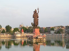
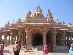
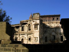
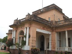
The foundation for the Khammam Fort was laid during the reign of Kakatiyas in 950 AD. But the construction and development of the fort continued for several centuries. The Fort, located on Stambhadri hill was further developed by the Reddi dynasty during fourteenth and fifteenth centuries and was subsequently taken over by the Qutb Shahi kingdom in 1531 AD. Khammam Fort represents both Hindu and Muslim architectural influences. The tall, pillar like stones, found in this hilly reign were used as pillars to support the ceiling of the structure.

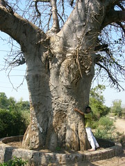
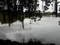
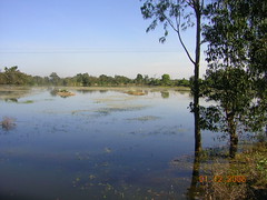
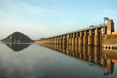
The district of Khammam is rich in forest cover. Over fifty percent of the land area is covered by timber like Teak and other valuable varieties. Coal is plentiful in Kottegudam and Illendu areas. Large deposits of Marble Stone are also found in some parts of the district. Kottegudam Thermal Power Station supplies power to this district.

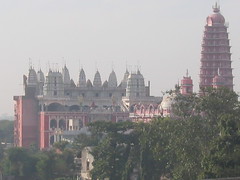
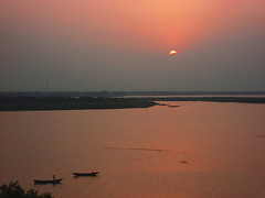
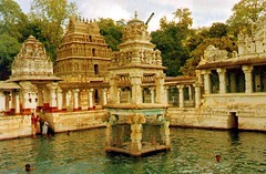
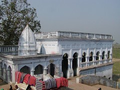
Bhadrachalam town is famous for the Sri Rama temple and is located amidst thick forest. The town is built on the banks of River Godavari. Bhadrachalam is about 120 kms from Khammam. The shrine is a pilgrimage site for Hindus and was built by Kancherla Gopanna popularly known as Bhakta Ramdas. Gopanna, a devotee of Lord Rama, built the shrine in 1630 AD.

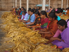
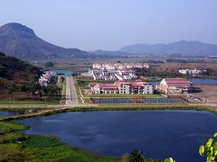
Bhadrachalam Paperboards Ltd, an integrated paperboard manufacturing facility was setup by ITC Ltd. in 1975 in the district of Khammam. ITC Bhadrachalam employs 10,000 people and 2,000 of these live in a planned colony with all modern facilities integrated into the complex. It is the largest single paper manufacturing unit in India.

Tuesday, January 22, 2008

Machilipatnam, Krishna District, Andhra Pradesh


Beach
Originally uploaded by kismetnyc.
Situated on the Coromandel Coast of India, Machilipatnam was an important port for the French, British and the Dutch trade. It was the first trading post for the British East India Company, on the Coromandel coast. Machilipatnam (eyes of a fish) was hit by Tsunami in 2004.

Vijayawada, Krishna District, Andhra Pradesh

Vijayawada, with a population of 825,000 people is the third largest city in Andhra Pradesh. The city is also known as the business capital of the state of Andhra. Located on the banks of Krishna River, Vijayawada is a center of Andhra culture.

In 1959, the Prakasam Barrage was completed and a railway bridge was built on the Krishna River. These projects have helped the region expand its agricultural and commercial base. Vijayawada Railway Station is one of the busiest railway junctions in India.

Monday, January 21, 2008

Kurnool, Kurnool District, Andhra Pradesh


mahanadi-temple
Originally uploaded by Indiravijay.
Kurnool was the capital of the area now known as Andhra Pradesh for a brief period of 3 years. There are ruins of the kingdom of Vijaynagar dating back to 14th century. The place was called 'Kaandanavolu' before it became Kurnool.

Sunday, January 20, 2008

Alampur, Mahbubnagar, Mahbubnagar District, Andhra Pradesh, India

Mahbubnagar city is the capital of Mahbubnagar District in the southern state of Andhra Pradesh. It is the largest district in Telangana Region and the second largest in Andhra Pradesh. Formerly known as "Palamooru", the name was changed to Mahbubnagar on December 4, 1890 AD, in honor of Mir Mahbub Ali Khan Asaf Jah VI, the then Nizam of Hyderabad. The district has a population of more than 3.5 million people, 90 percent of them speak Telugu and the rest 10 percent identify as Muslims or Urdu speaking people.

The town of Mahbubnagar is located only 96 kms southwest of Hyderabad and yet it is the most backward district in Andhra Pradesh. Even today the people of this region struggle for the basic needs of life. The agriculture activity is intensive and the groundwater resources are meager. Telangana region as a whole is short of water. Drought is ever persistent in Mahbubnagar District. Majority of the farmers are small and marginal.

Mahbubnagar is well connected by road rail and air with all important towns and cities in the State because of the proximity to the state capital. This transportation infrastructure was created during Nizam's period. The most important place of interest near Mahbubnagar is the famous 500 years old Banyan tree called "Pillalamarri". The site is 8 kms from the city and covers an area of three acres. The tree is visited by thousands of people and there is a shrine of a Muslim saint under the tree.

Alampur is another important destination located in Mahbubnagar District. Alampur is only 90 kms from Mahbubnagar city and is home to ancient Navabhramma temples. These nine temples are dedicated to Shiva. The Tungabhadra and Krishna rivers converge near Alampur. The entire district is covered under Krishna River Basin. The district is known for providing large numbers of human labour around the country. It is estimated that more than half a million people travel to far corners of the country for work.

Union Minister for Urban Development, S. Jaipal Reddy is a native of Mahbubnagar District.

Saturday, January 19, 2008

Medak, Sangareddy, Medak District, Andhra Pradesh, India

Medak is a historic city, located in Medak District of Telangana region of Andhra Pradesh. It is a historic city, originally called Siddapur. Medak City is 100 kms north of Hyderabad. Medak has a citadel dating back to the Kakatiya Empire. The Fort was built on a hillock by Pratapa Rudra, the Kakatiya Emperor. It is a fine piece of architectural and military excellence.

Friday, January 18, 2008

Nalgonda, Nalgonda District, Andhra Pradesh


bidi
Originally uploaded by thebigdurian.
Located in the heart of Andhra Pradesh, Nalgonda has a population of more than 100,000 people. The city has an average literacy rate of 78%, higher than the national average of 59.5%.

The name Nalgonda means Nalla(Black) + Konda (Hill). This city is hill locked between two hills KaapuRaala Gutta and Lateef Shahi Gutta. Gutta in Telugu means hill.

Thursday, January 17, 2008

Nellore, Nellore District, Andhra Pradesh

Situated on the south and north banks of Pennar River, Nellore is an emerging city of 700,000 people in the State of Andhra Pradesh. The city attracts a lot of immigrants from other parts of the country because of the flourishing aquaculture industry and paddy cultivation. The Flamingo Festival is celebrated in this district's famous bird sanctury at Nelapattu.

Formerly a part of the composite Madras State, Nellore district came under Andhra Pradesh, when the States were re-organized on a linguistic basis on November 1, 1956. Potti Sriramulu, a Telugu patriot and activist, fasted to death for the formation of Andhra State within the Indian Union.

Wednesday, January 16, 2008

Nizamabad, Nizamabad District, Andhra Pradesh


Formerly known as Indur or Indrapuri, Nizamabad is located in the Telangana Region of Andhra Pradesh. A city of 365,000 people was ruled by Rashtrakutas in the 8th century. The city was named after the King "Indra Vallabha Panthya Varsha Indra Som". A railway line was constructed between Secundrabad and Manmad in 1905. The railway station was named after the Nizam and was called Nizamabad. The city also came to be known as Nizamabad for "Nizam-ul-Mulk".

Tuesday, January 15, 2008

Ongole, Prakasam District, Andhra Pradesh

A major center for tobacco trading, Ongole is a small town in the State of Andhra Pradesh. The city has a population of 150,000 people most of whom are employed in the granite mining, stone cutting and polishing industry.

Ongole is famous for its Ongole breed of oxen which are considered virile and of superior stock. They are one of the major Zebu cattle breeds of the world.

There is a very old Lord Shiva temple in the town.

The name "Ongole" is derived from Omgole, roughly translated as submitting to Shiva.

Monday, January 14, 2008

Rangareddy District, Andhra Pradesh, India

Rangareddy District encircles the city and the district of Hyderabad. This district is named after the famous freedom fighter and Telanga leader, Ranga Reddy.

Sunday, January 13, 2008

Srikakulam, Srikakulam District, Andhra Pradesh

A town of 100,000 people, Srikakulam is located on the banks of Nagavali River in the coastal district of Andhra Pradesh. Since it shares a border with the east Indian State of Orissa, a significant number of people can understand and even communicate in Oriya. The primary language of Srikakulam is Telugu.

Saturday, January 12, 2008

Vishakhapatnam, Visakhapatnam District, Andhra Pradesh


Vizag Beach From Kailashgiri
Originally uploaded by Kam Dhen.
The second largest city in Andhra Pradesh with a population of over 2 million people, Vishakhapatnam has India's largest shipbuilding yard. The city, popularly known as Vizag, has a giant steel plant and a large fertilizer factory. The area has large deposits of minerals.

A tiny humble fishing village, became a part of the powerful Kalinga Empire that was conquered in a bloody war by the Emperor Ashoka in 260 BC. After the conquest, Ashoka was so shaken by the violence that he renounced war and eventually became a non violent Budhist.

Anakapalle, Visakhapatnam District, Andhra Pradesh

The town was originally under the rule of the Kalinga Empire, and later came under the rule of the Gajapati, Telugu, and Qutb Shahi empires. Around 1450, Appalaraju began to rule the region under the Nawab of Arcot, with Anakapalle as his fortified headquarters. When the British took control of the area in 1803, local leaders were poisoned or hung.

Anakapalle is a small town in Visakhapatnum district of Andhra Pradesh, with a population of only 85,000 people. It is the largest source of Gur (jaggery) in southern India.

Friday, January 11, 2008

Vizianagaram, Vizianagaram District, Andhra Pradesh


giant flowering teak tree
Originally uploaded by bhanu2811.
Rulers of this Zamindari belong to the Pusapati family. The village Pooshpadu in Nandigama Taluq was built by Amala [Raju]]. The village later came to be known as Pusapadu. Therefore, the Kshatriyas living there came to be known as Pusapati.

In 1754, Pusapati Vijayarama Gajapathi Raju, of the ruling family of Vizianagaram, made an alliance with the French, but a few years later the territory was ceded to the British. It remained under their control until independence in 1947.

The population of the city is estimated to be around 175,000 people.

Thursday, January 10, 2008

Warangal, Warangal District, Andhra Pradesh


Located in Telangana region of Andhra Pradesh, Warangal is the fourth largest city in the state, with a population of more than a million people. The city serves as a major urban center for the backward Telangana region. Warangal is well known for granite quarries.

Warangal was the capital of a Hindu Shaivite kingdom ruled by the Kakatiya dynasty from 12th to the 14th centuries. Kakatiya rule ended in the 14th century, when Warangal was conquered by the Muslim-ruled Bahmani Sultanate. Later, Golconda sultanate ruled Warangal.

Wednesday, January 09, 2008

Eluru, West Godavari District, Andhra Pradesh, India

Eluru is the state capital of West Godavari District in the southern state of Andhra Pradesh.

As the town of Eluru was built up very near to the ancient capital of Vengi it has got many historical monuments in and around it. Muslims who brought stones from the temples at Vengi built the Fort of Eluru.

Sunday, September 30, 2007

Itanagar, Arunachal Pradesh.


A Girl from Arunachal Pradesh.
Originally uploaded by arunchs.
Itanagar is situated at the foothills of Himalayas and is the capital of Arunachal Pradesh. The Nishi, also known as the Nishing, is the major tribe in Itanagar area. The city is named after the Itafort which dates back to the 15th century.

A beautiful yellow roofed Buddhist temple reflects the Tibetan influence and provides good view of Itanagar and the surrounding areas.

Saturday, September 15, 2007

Guwahati, Assam


VIP Road revisited
Originally uploaded by skataria.
The gateway to the north-east part of the country, Guwahati is close to Dispur, the capital of the Indian state of Assam. The city is between the southern bank of Brahmaputra river and the foothills of the Shillong plateau. Guwahati was situated midway between two powerful kingdoms, the Ahom and the Koch kingdoms.

Today Guwahati is important because it is the commercial center of Assam and is also the hub that connects six other northeastern states of Arunachal Pradesh, Nagaland, Manipur, Mizoram, Meghalaya and Tripura. The city has a population of over 2.5 million people. The picture is of the Indian Institute of Technology, Guwahati.

Tuesday, September 04, 2007

Patna, Bihar


Jalan Museum (Quila House), Patna
Originally uploaded by /jjj/.
Located on the Southern bank of Ganges, the modern city of Patna is the capital of the Indian State of Bihar. A bustling city of 1.2 million people, Patna was the famed Patliputra, the seat of power and nerve center of the sub-continent. From Patliputra, the mighty emperor Chandragupta Maurya ruled a vast empire, stretching from Bay of Bengal to Afghanistan. Early Mauryan Patliputra was mostly built with wooden structures. Emperor Ashoka, the grandson of Chandragupta Maurya, transformed the wooden capital into stone construction around 273 BC.

Muzaffarpur, Bihar


Shahi Litchees
Originally uploaded by scorius.
Muzaffarpur is famous for Litchis, a fruit found only in a few places in the world. This city is also known for a medical collage and an engineering collage. Muzaffarpur is a leading center of education and boasts of one of the oldest unversities of North Bihar.

Bodh Gaya, Bihar

Bodh Gaya complex is located about 96 kilometers from Patna in the state of Bihar. It contains Mahabodhi Temple, built over 2,500 years back, and is the place of Buddha's Enlightenment. Bodh Gaya is the most important pilgrimage site for Buddhists.

Prince Gautama Siddartha (Gautama Buddha), wandering as a monk, reached the banks of Falgu River near the city of Gaya. There he sat in meditation under a peepal tree and after three days and nights of meditation, Siddharta (Buddha) attained enlightenment.

Gaya, Bihar


P5140700
Originally uploaded by juicyrai.
Situated on the banks of Falgu River, Gaya is a place sanctified by both Hindu and the Buddhist religions. It was part of the ancient Magadh.

Documented history of Gaya dates back to the birth of Gautam Buddha. About 15 km from Gaya town is Bodh Gaya, the place where Lord Buddha got enlightenment.

Bhagalpur, Bihar


whitewashed
Originally uploaded by anokhisp.
Bhagalpur silk is well-known in India and abroad. The silk production in the city is hundreds of years old and a whole community exists that has been producing silk for generations. Bhagalpur has a silk institute to preserve this craft.

The city is located on the southern banks of Ganga river in the eastern state of Bihar. The snake queen (Nageen) is worshiped during "Vishaili Puja" and the tradition goes back hundreds of years.

Saturday, September 01, 2007

Raipur, Chhattisgarh


Dawn in a village n India
Originally uploaded by flickerHS.
Raipur is the capital of the newly created State of Chhattisgarh. It was formarly a part of Madhya Pradesh. Located to the west of Mahanadi River, Raipur has a population of 600,000 people.

The city of Raipur is located near the centre of a large plain, sometimes referred to as the “rice bowl of India” - where hundreds of varieties of rice are grown.

The airport in Raipur is situated in the outskirts of the city, in the village of Mana. The airport is popularly known as Mana Airport. It is the sole commercially operating airport of Chattisgarh state.

Bhilai, Chhattisgarh


Bhilai Surya Vihar House
Originally uploaded by arnav_mishra.
The city of Bhilai Steel Plant is the second-largest in Chhattisgarh, with a population of over half a million people. The city is only 40 km from the state capital, Raipur. Amil Sana of Indian Idol fame hails from Bhilai.

Formerly a small town, Bhilai grew rapidly after the construction of one of the biggest steel plants in the country. The pace of development has increased since the formation of Chhattisgarh as a seperate state.

Bilaspur, Chhattisgarh


a hamlet called bilaspur
Originally uploaded by a c h a n.
Bilaspur town with a population 250,000 people is located on the banks of Arpa River, in the newly created state of Chhattisgarh. The town is known for its tasty and aromatic Doobraj rice and handloom woven colorful soft Kosa silk sarees.

Bilaspur is developing as a center of education for Chhattisgarh. Students from all over the state come to study engineering, medicine and administrative officers' competitive exams.

The downtown is called Goal (round) Bazaar and Sadar Bazaar.

Thursday, August 30, 2007

Delhi (Akshardham Temple), India

Delhi is the national capital of India with a population of more than 15 million people. Pandavas founded Indraprastha around 5,000 BC. Delhi is believed to be the site of Indraprastha. Delhi is probably one of the fastest growing cities in the world.

The Baha's Lotus Temple, the growing Delhi Metro and the imposing Swaminarayan Akshardham Temple are the new landmarks in Delhi.