Monday, July 31, 2006

Diu, Union Territory, India


Diu Fort IV
Originally uploaded by fuersten.
Diu is an island lying off the south coast of Gujarat's Kathiawar peninsula, separated from the mainland by a tidal creek. The town of Diu lies at the eastern end of the island and is famous for its fortress and an old Portuguese Cathedral. It is a fishing town.

For over 450 years, these coastal enclaves on the Arabian Sea coast were part of Portuguese India, along with Goa, Dadra and Nagar Haveli. Goa, Daman and Diu were incorporated into the Republic of India on December 19, 1961. Portugal did not recognize Indian rule in these territories until 1974.

Tuesday, July 18, 2006

Karaikal, Pondichery


A00405_032A
Originally uploaded by santh0sh.
Karaikal is known for its rich religious heritage. It is one of the four regions of the Union Territory of Pondichery. It was a French colony and the flavour still persists in this untouched peaceful land of Karaikal.

Kavaratti, Lakshadweep, india


lakshadweep kavaratti india
Originally uploaded by Thejas.
Kavaratti is an island in the Union Territory of Lakshadweep, off the coast of Kerala. 52 mosques are located throughout the island, including Usra Mosque. Water from a well near the mosque is believed to have curative powers. The beautiful and calm lagoon offers an ideal spot for water sports and swimming.

Tuesday, July 04, 2006

Siliguri, West Bengal


Bridge over Teesta River
Originally uploaded by rajivlodha.
Siliguri is located in the Chicken's Neck, a very narrow strip of land linking mainland India to its north eastern states, on the Mahananda River. The city is rapidly developing metropolis in the Indian State of West Bengal. Siliguri has a population of 250,000 people. The city is situated in Darjeeling district.

The people of Siliguri are mostly Bengali or Nepali and these are the two most widely spoken languages here. Tea, timber and transport are the main businesses of Siliguri.

Kolkata (Calcutta), West Bengal


Victoria Memorial
Originally uploaded by HappyHorizons.
Job Charnock, an administrator of the East India Company is credited as the founder of the city in 1690. The British completed the construction of the Old Fort William in 1699, which was used to station its troops as a regional base. Faced with frequent skirmishes with French forces, in 1756 the British began to upgrade their fortifications. The Nawab of Bengal, Siraj-Ud-Daulh protested and then captured Fort William. A force of the Company sepoys and British troops led by Robert Clive recaptured the city the following year. Calcutta was named the capital of British India in 1772. The city served as the capital in India during the British Raj until 1911.

Located on the east bank of the Hooghly River, Kolkata is the capital of the Indian State of West Bengal. The city has a population of almost 5 million, with an extended metropolitan population of over 14 million, making it the third-largest urban agglomeration and the fourth-largest city in India.

Bakkhali, West Bengal


just lust
Originally uploaded by caprinjoy.
Bakkhali is a seaside resort in South 24 Parganas district of West Bengal, India. It is located on one of the many deltaic islands spread across Southern Bengal. Most of the islands are part of the Sunderbans, barring a few at the fringes. Some of these are joined together with bridges over narrow creeks. This small island juts out into the vast expanse of the Bay of Bengal.

Sir Andrew Fraser, Lieutenant Governor of Bengal in the early twentieth century, is credited with “discovery” of the place. He tried his best to popularize it and in recognition of his efforts a part of the town is named Frasergunj. There is a dilapidated house near the beach, which according to the locals was the one in which Fraser used to stay.

Local legend has it that he had landed at the place accidentally because of a shipwreck and was helped to survive by a local woman named Narayani. Fraser fell in love with her and visited her regularly. His detractors sent word about his goings on to his wife staying back in England. She came rushing to India and with the assistance of British troops had Narayani shot down. Frasergunj was earlier known as Narayanitala.

Krishnagar, West Bengal


Located on the banks of Jalangi River, Krishnagar is a town, just 118 km north of Kolkata in the eastern State of West Bengal. It is the capital of Nadia District and is well connected by road to different parts of the State. The town was the residence of Maharaja Krishnachandra, a great patron of art and culture.

In a locality of Krishnagar called Ghurni, there is a colony of artists who work with clay. These artists produce images of Hindu gods and goddesses for traditional worship throughout the year, as well as clay models of human figures and real life objects.

Halwaikars or moyras of Krishnagar are famous. While they produce all varieties of sweets, there are some which bear the hallmark of the city. 'Sarbhaja' and 'Sarpuria' are inventions that mark the talent of Krishnagar's halwaikars.

Purulia, West Bengal


purulia
Originally uploaded by Evan Lane.
Located on the north of Kasai River, Purulia is a small town in West Bengal state of India. It is a major road and railway junction. Purulia is also famous for the prestigious institution named Ramakrishna Mission Vidyapith. This is a residential school for boys with the calm environment of ancient gurukul system which was the ideology of Swami Vivekananda.

Purulia entered the news in December 1995, when a Latvian aircraft dropped a large consignment of arms into its vicinity. Several days later, when the plane re-entered Indian airspace, it was intercepted by the MiG21 Indian Air force Jet planes, and its crew were captured. It was believed that the arms were intended for the Hindu cult Anand Marg ("Happy Path"), but proof of this could not be established. The crew of the aircraft consisted of five Latvian citizens and Peter Bleach, a British citizen. They were arrested and sentenced to life imprisonment. Following the intervention of Russian authorities, the Latvian crew (ethnic Russians) were later pardoned and released in 2000.

Bardhaman (Burdwan), West Bengal


Noorjahan
Originally uploaded by mehtakk55.
The town was the capital of Maharaja of Burdwan, a major figure of lower Bengal. Bardhaman Raj was founded in 1657 by Sangam Rai of the Kapur Khatri family of Kotli in Lahore, Punjab, whose descendants served the Mughal Emperors. During the reign of Jahangir this place was named Badh-e-dewan. Noor Jahan (Jahangir's wife) once lived in this city and later ruled India.

Birbhum, West Bengal


Baul
Originally uploaded by partha Pal.
The folk culture of Birbhum is specially enriched with the contribution of Bauls, their philosophy and their songs. Baulism is a religiously liberal philosophy and lifestyle which might have some links to Sahajiya movement of 16th century A.D. (derived from Sahajyan, a form of Vajrayana Buddhism, influenced also by Vaishnavism and Sufism). Chandidas and many other poets were part of the Sahajiya movement. The Bauls earn their living by singing and collecting alms. They accommodate people from any caste and creed. Among the singers who brought baul songs to worldwide fame are Purnachandra Das, popularly known as Purnadas Baul.

Birbhum is a District in West Bengal. It lies on the western periphery of the State. The headquarters of Birbhum are at Siuri. Birbhum is famous for its topography and cultural heritage which is unique and somewhat different from that of the other districts in West Bengal.

Haldia, West Bengal

Haldia is a major seaport in Midnapore District of West Bengal state, India, located approximately 50 kilometers southwest of Calcutta near the mouth of the Hooghly River, one of the distributaries of the Ganges. This city of only 100,000 people is being developed as a major trade port for Calcutta, intended mainly for bulk cargoes.

Haldia has now become the prime center for the development of West Bengal. The industrial city has several factories like Indian oil Corporation Limited (IOCL), Exide, Shaw wallace, Tata Chemicals, Petrochemical Complex (Haldia Petrochemical) and Hindustan Lever, in addition to various light industries. The port has attracted factories of foreign companies, like Mitsubishi Chemical Company (MCC). A large number of companies are also being set up now, primarily being ancillary industries to the Haldia Petrochemicals. The Haldia Petrochemicals is the second largest project of such kind in whole of India.

Darjeeling, West Bengal

Darjeeling is internationally famous for its tea industry and the Darjeeling Himalayan Railway, a UNESCO World Heritage Site. The tea plantations date back to the mid 1800s as part of a British development of the area. The tea growers of the area developed distinctive hybrids of black tea and fermenting techniques, with many blends considered among the world's finest.

The British established experimental tea plantations in Darjeeling in 1841. The success of these experiments led to the development of tea estates all around the town in the second half of the 19th century. Darjeeling was annexed by the British Indian Empire a few years after an incident of discord between Sikkim and the Company in 1849.

Scottish missionaries undertook the construction of schools and welfare centers for the British residents, laying the foundation for Darjeeling's high reputation as a center of education. The opening of the Darjeeling Himalayan Railway in 1881 hastened the development of the Region.

The Darjeeling Himalayan Railway connecting the town with the plains was declared a World Heritage Site in 1999 and is one of the few steam engines still in service in India.

Chandannagar, West Bengal


Bath time
Originally uploaded by dying_giraffe.
Chandannagar was established as a French colony in 1673, when the French obtained permission from Ibrahim Khan, the Nawab of Bengal to establish a trading post on the right bank of the Hughli River. Bengal was then a province of the Mughal Empire. It became a permanent French settlement in 1688, and in 1730 Joseph François Dupleix was appointed the Governor of the city, during whose administration more than two thousand brick houses were erected in the town and a considerable maritime trade was carried on. For a time, Chandannagar was the main center for European commerce in Bengal.

In 1756 war broke out between France and Great Britain, and Colonel Robert Clive of the British East India Company and Admiral Charles Watson of the British Navy bombarded and captured Chandannagar on March 23, 1757. The town's fortifications and many houses were demolished thereafter, and Chandannagar's importance as a commercial center was eclipsed by that of Calcutta just downriver. Chandernagar was restored to the French in 1763, but retaken by the British in 1794 in the Napoleonic Wars. The city was returned to France in 1816, along with a 3 square miles enclave of surrounding territory. It was governed as part of French India until 1950, under the political control of the governor-general in Pondicherry. By 1900 the town's former commercial importance was gone, and it was little more than a quiet suburb of Calcutta, with a population of 25,000 (1901). The European town was noted for its clean wide thoroughfares, with many elegant residences along the riverbank.

Asansol, West Bengal

Asansol is the second largest city in West Bengal, after Kolkata. The city has a population of over one million people. This coal-mining industrial center is located in Damodar River Valley.

The city's economy is primarily based on the coal and steel industries. Asansol is an important educational hub, acting as the center for the entire population of the coal belt from Dhanbad to Ranigunj

Dakshin Dinajpur, West Bengal


The Dakshin Dinajpur, also known as South Dinajpur, district was created on April 1, 1992.

The erstwhile Dinajpur District, at the time of partition of India, was split up into West Dinajpur and East Dinajpur. The East Dinajpur district, now called Dinajpur is now in Bangladesh. The West Dinajpur district was enlarged in 1956 at the time of re-organization of the State with the addition of some areas of Bihar. The district was bifurcated into Uttar Dinajpur and Dakshin Dinajpur on April 1, 1992.

Dakshin Dinajpur is predominantly an agricultural district with large area of land under cultivation. The district is drained by a number of North-South flowing rivers like Atreyee, Punarbhaba, Tangon and Brahmani, to give rise to a sizeable but non-organized fishing community.

Kurseong, West Bengal


The latest tea picker
Originally uploaded by Amberly & David.
Kurseong is a hill station situated in Darjeeling District of West Bengal, India. Ceded to the British by the King (Chogyal) of Sikkim in 1835 as a small village, it gained prominence in 1880, when the Darjeeling-Himalayan Railway was extended to it on 23rd August, 1880.

The local name of Kurseong is called "Kharsang" which in the Lepcha language means "Land of the White Orchids". Kurseong is 47 km from Siliguri and is connected to the city by road and the Darjeeling Himalayan Railway. The nearest airport is at Bagdogra.The nearest major railway station is New Jalpaiguri, which is about 53 kilometers from Kurseong. The town is based mainly on schools and tourism. The best times to visit Kurseong are between March end and May and between the end of August and October.

Cooch Behar, West Bengal


Here I go...
Originally uploaded by Sauzz.
During the British Raj, Cooch Behar was the seat of a princely state of the same name ruled by the Narayan dynasty. In course of time, Cooch Behar has been transformed from a Kingdom to a State and from a State to the present status of a District. Before 28th August, 1949, Cooch Behar was a Princely State ruled by the King of Cooch Behar, who had been a feudatory ruler under British Government. By an agreement dated 28th August, 1949 the King of Cooch Behar ceded full and extensive authority, jurisdiction and power of the State to the Dominion Government of India. The transfer of administration of the State to the Government of India came into force on 12th September, 1949. Eventually Cooch Behar was transferred and merged with the province of West Bengal on 19th January, 1950, and from that date Cooch Behar emerged as a new District in the administrative map of West Bengal.

Jalpaiguri, West Bengal


Jalpaiguri
Originally uploaded by P A T R I C E.
Jalpaiguri derives its name from the olive fruit, which is locally known as ‘jalpai’ – it literally means a place where olives are found abundantly. It is a small town of only 100,000 people located in North Bengal Region in the State of West Bengal.

Jalpaiguri was initially founded as a trading center, as the origin of its name suggests. The town was part of the Duars area of the old Kamarupa and later the Bhutanese Kingdom which was later annexed by the British in 1864.

The town saw its main boom period during the late 19th and early 20th century, when the British found the region north-east of the town (called the Dooars Region), near the foothills of the Bhutan hills very suitable for tea cultivation. Within a very small period the area was dotted with thousands of tea gardens, with Jalpaiguri town becoming the port-of-call for all going to those gardens. People flocked to the town to lay their hands on a part of the lucrative tea-trade. This resulted in the cosmopolitan nature of the town, with people from many parts of the country settling there. Business boomed and the town established itself as the premier commercial and cultural hub of the northern Bengal Region. It also helped that the town was well connected with Kolkata (then Calcutta), as it lay on the main Railway link between Calcutta and Darjeeling.

Damodar River, West Bengal


Fishing in Damodar River
Originally uploaded by shyamal112.
Damodar River originates near Chandwa village, Palamau District, on the Chota Nagpur Plateau in the Jharkhand State in eastern India and flows eastward for about 592 km through the States of Jharkhand and West Bengal to the estaury of the River Hughli. It has a number of tributaries and subtributaries, such as Barakar, Konar, Guaia, Jamania, Usri, Bokaro, Haharo, Khadia and Bhera.

Damodar River was earlier known as the Sorrow of Bengal as it used to flood many areas of Bardhaman, Hughli, Howrah and Medinipur Districts. Even now the floods sometimes affect the lower Damodar Valley but the havoc it wreaked in earlier years is now a matter of history.

In 1789 an agreement was signed between Maharaja Kirti Chand of Burdwan and the East India Company wherein the Maharaja was asked to pay an additional amount of Rs. 1,93,721 for the construction and maintenance of embankment to prevent floods. However, these ran into a dispute and in 1866 and 1873, The Bengal Embankment Act was passed, transferring the powers to build and maintain embankemnt to the government.

The Damodar Valley is spread across Hazaribagh, Koderma, Giridih, Dhanbad, Bokaro and Chatra districts in Jharkhand and Bardhaman and Hughli districts in West Bengal and partially covers Palamau, Ranchi, Lohardaga and Dumka in Jharkhand and Howrah, Bankura and Purulia in West Bengal with a command area of 24,235 sq km.

The Damodar Valley contains large reserves of coal and mica, and the area is a highly developed industrial belt. Many refer to the Damodar Valley as the Ruhr of India because of its similarities with the Ruhr mining-industrial area of Germany. The dams on the Damodar River have several hydroelectric power plants. Of late, the Damodar has become one of the most polluted rivers of India, with chemicals, mine rejects and toxic effluents flowing into the river from mines and industries located in the valley. Efforts are being made to reduce the level of pollution in the river.

Bardhaman, West Bengal


interesting texture on doors
Originally uploaded by pavangupta.
Bardhaman Raj was founded in 1657 by Sangam Rai of the Kapur Khatri family of Kotli in Lahore, Punjab, whose descendants served the Mughal Emperors and the British government. The great prosperity of the Raj was due to the excellent management of Maharaja Mahtab Chand (d. 1879), whose loyalty to the government, especially during the “Hul” (Santhal rebellion) of 1855-56 and the Indian rebellion of 1857, was rewarded with the grant of a coat of arms in 1868 and the right to a personal salute of 13 guns in 1877. Maharaja Bijai Chand Mahtab (b. 1881), who succeeded his adoptive father in 1888, earned great distinction by the courage with which he risked his life to save that of Sir Andrew Fraser, the lieutenant-governor of Bengal, on the occasion of the attempt to assassinate him made by Bengali malcontents on 7 November 1908.

The city of Bardhaman is situated 100 km north-west of Kolkata, on the banks of Damodar River and Banka Nala. Bardhaman has been a district capital since the time of Mughals. Burdwan is an alternative name for the city.

Purulia District, West Bengal


Netai is a Dhokra artist
Originally uploaded by arnabchat.
The District of Purulia in Bengal was once a great center of Jainism. The area of this district was the connecting link with Orissa and Bihar. Jainism as a religious creed had a great hold on Orissa and there is no wonder that there should be a considerable impact of Jainism on the adjoining Purulia District. Purulia was also the via media through which a close contact with Bihar was maintained.

1 Purulia District previously formed a part of Manbhum District in Chotanagpur Division of Bihar. According to the implementation of the recommendations of the States Reorganization Commission, a portion of Manbhum District was made over to Bengal and now forms Purulia District. The town of Purulia, which headquarters the district now, was also the headquarters of Manbhum District in Bihar.

Durgapur, West Bengal


durgapur_citycentre
Originally uploaded by alokeshgupta.
The brain child of Dr. Bidhan Chandra Roy, the second chief minister of West Bengal, Durgapur is an industrial township. The well laid out town was designed by Joseph Allen Stein and Benjamin Polk. It is home to the largest industrial unit in the state of West Bengal. Durgapur Steel Plant, one of the integrated steel plants of SAIL is located here.

Malda District, West Bengal


M A N G O E S . Gaur
Originally uploaded by Claude Renault.
Malda is called the gateway of North Bengal. It was once the capital of Gour-Banga. It lies just east of the confluence of the Mahananda and Kalindri Rivers and is part of the English Bazaar urban agglomeration. The town rose to prominence as the river port of the Hindu capital of Pandua. During the 18th century, it was the seat of prosperous cotton and silk industries.

Mulberry plantations and mango orchards occupy large areas, mango trade and silk manufacture are the main economic activities.

The economy of the district is basically agrarian and ranks as one of the most underdeveloped Districts in West Bengal. Malda has a low per capita income, low yield per unit area, poor industrialisation, shortage of capital and entrepreneurship, and also a lack of infrastructure and large labor surplus.

Contai, West Bengal


Give me Ray I
Originally uploaded by partha Pal.
Contai was originally a part of Hijli Kingdom, a tributary State of Orissa ruled by the Hindu King Gopinath Pattnayak. Contai Subdivision was established in 1852, under the British Raj. Initially, Negua was the Subdivisional headquarter, which was shifted to Contai in 1863. Rishi Bankim Chandra Chattopadhyay was appointed as the Subdivisional officer in 1860. He selected Dariapur as the background of his famous novel "Kapalkundala". Dariapur is just few kilometers from Contai city and is situated by the Bay of Bengal at the confluence of Rasulpur River and Hooghly River.

Contai is a subdivisional town in the District of East Midnapore, in the State of West Bengal. It is about 160 km from Kolkata and 30 km from the beach town of Digha.

Balurghat, Dakshin Dinajpur, West Bengal


music man | crafts fair@Kolkata
Originally uploaded by arnabchat.
Balurghat College is a co-ed institution of higher education located in Balurghat, Dakshin Dinajpur district, West Bengal, India.

Balurghat College was established in June, 1948, as an intermediate liberal arts college, with 96 students. In 1950, the college was recognized by the UGC, and it is supported by the West Bengal government as an aided college. North Bengal University accepted the college as a constituent college in September 2003.

Today, the college has grown into a a degree college of over 3000 students, with undergraduate education in Arts and Sciences, Commerce, and postgraduate courses in Bengali and Commerce. Distance education is offered through North Bengal University, and the college serves a study centre for Netaji Subhas Open University and Indira Gandhi National Open University.

Haldi River, Haldia, West Bengal


Haldi River At Haldia
Originally uploaded by $uvo.
Haldia is located at the junction of River Haldi and Hoogly. It is one of the major ports of India forming a part of Kolkata port complex. The waterfront at Haldia is a major social venue for the local population.

The major industrial companies in the area are Haldia Chemicals, Indian Oil Corporation, Hindustan Lever and Exide Industries.

Shantiniketan, West bengal

Shantiniketan is a small town near Bolpur in the Birbhum District of West Bengal, India, and approximately 180 kilometres north of Kolkata (formerly Calcutta). It was made famous by Nobel Laureate Rabindranath Tagore, whose vision became what is now a University town (Visva-Bharati University) that attracts thousands of visitors each year. Shantiniketan is a tourist attraction because of Tagore.

Shantiniketan was earlier called Bhubandanga (named after Bhuban Dakat, a local dacoit), and was owned by the Tagore family. Rabindranath's father Maharshi Debendranath Tagore found it very peaceful and renamed it Shantiniketan, meaning abode (niketan) of peace (shanti).

Bankura, West Bengal


Bankura Horses
Originally uploaded by Rahul Matthan.
Bankura is located in the western part of the Indian State of West Bengal. It is a part of Bardhaman Division of the State and included in the area known as "Rarh" in Bengal. It ranks fourth according to the population and literacy rate of 2001 Census in the State. River Damodar flows along the northern boundary of the district.

Bankura is an agricultural distributing center. Rice and oilseed milling, cotton weaving, metalware manufacture, and railway workshops are the major industries. Constituted a municipality in 1869, Bankura has several colleges, including a medical school, affiliated with the University of Burdwan. Bankura lies on a densely populated alluvial plain. Rice, wheat, corn (maize), and sugarcane are the chief crops in the surrounding agricultural area; mica, china clay, iron-ore, lead, zinc, and wolframite deposits are also worked in the locality.

Midnapore, West Bengal


p1010627
Originally uploaded by whateverfitstoday.
Midnapore is a town of 150,000 people in the State of West Bengal. Kharagpur is located on the opposite side of the banks of Kangsabati River. The town used to belong to the Midnapore District before it was divided into East and West in 2002. Midnapore belongs to the West Midnapore District.

The Jagannath Temple of Midnapore is an age old temple of the town. The Ramakrishna Mission also has a temple adjacent to an elementary and high school. The Goddess Kali at the Battala temple is an important temple in the locality.

Midnapore is famous for it's contribution in the history of Indian freedom movement since it has produced a seemingly endless list of martyrs.

Khudiram Bose and Satyendranath Basu were some of the young men that laid down their lives for the freedom of India.

Digha, West Bengal


Digha
Originally uploaded by Rosie Shakespear.
Digha is West Bengal's most popular sea resort. Originally known as Beerkul, it is mentioned as the "Brighton of the East" in one of Warren Hasting's letters (1780 AD) to his wife.

In 1923, an English tourist - John Frank Smith - was charmed by the beauty of Digha and started living there. His writings about Digha slowly gave exposure to this place. After independence, he convinced West Bengal's chief minister Dr. Bidhan Chandra Roy to develop Digha as a beach resort.

Digha is a hard beach where one can drive during low tide. The beach is however facing the problem of sea erosion.

Bathing is advisable only during the low tide. One can view both sunrise and sunset at Digha sea beach.

Kolkata (Calcutta), West Bengal


a bird's view
Originally uploaded by arnabchat.
The cultural capital of India is the best way to describe Kolkotta. Talented, colorful and very emotional, the people of Calcutta (Kolkotta) have so much to offer, it is difficult to express the feeling through one image. It is truly the "City of Joy".

Calcutta was the capital of the British Raj till 1911. The city is governed by a communist government for the past 3 decades. Kolkota is the city of Tagore, Subhas Chandra Bose, Mother Teresa and Satyajit Ray.

Murshidabad, West Bengal


W A T E R. Murshidabad
Originally uploaded by Claude Renault.
The last capital of the Nawabs of Bengal, Murshidabad is one of the oldest cities of West Bengal. The city is mainly a trading center for agriculture and silk saries.

In 1704, the Diwan of Bengal, Murshid Quli Khan shifted the capital of Bengal from Dacca to the new location and renamed the city, Murshidabad.

Barrackpur, West Bengal


Jagannath Temple in Barrackpore
Originally uploaded by somnathB.
Barrackpore (now Barrackpur) is the place near Kolkata where Mangal Pandey, the first warrior of India's stuggle for independence, attacked the British sergeant on March 29, 1857. The first British barrack was built at Barrackpore, providing the town with its name. Prior to that the town was called Chanak.

From 1600s, the area was ruled by a line of Zamindars (landlords), the first in line was Kalidas Sarkar. He was followed by his son Bishwambhar Sarkar and grandson Nilmoni Sarkar. The old 'Sarkar Bari', a large red brick house with ramparts, which was the home of zamindars, is still standing in Barrackpur.

Murshidabad, West Bengal


G R E E N. Murshidabad
Originally uploaded by Claude Renault.
Located on the southern banks of Bhagirathi River (a tributary of Ganges River), Murshiabad is a city in West Bengal, India.

Murshidabad has witnessed treachery and palace politics, which finally resulted in passing off of Bengal into the hands of the East India Company. Siraj-ud-Daulah was the last independent Nawab of Bengal. In 1757 AD, a conspiracy between East India Company and his uncle Mir Jafar led to defeat of his forces by the Company troops in the battle of Plassey. He was later murdered in Murshidabad. Mir Jafar, who betrayed Siraj became the new puppet Nawab. The East India Company reigned from here after the battle till they shifted their capital to Calcutta.

The Hazaar Dwari Palace or the Palace with Thousand Doors is probably the chief attraction of Murshidabad. Duncan McLeod of the Bengal Engineers built the palace for the Nawabs of Bengal in 1837 AD. The palace took 17 years to build, which has been converted into a museum today. It has 114 rooms and 8 galleries. The museum has various works of art including an exquisite collection of armory, splendid paintings, exhaustive portraits of the Nawabs, beautiful works of ivory from Murshidabad School, China (European) and many other valuables. The Armory has 2700 arms in its collections out of which only few are displayed. Swords used by Siraj-ud-Daulah and his grandfather, Nawab Ali Wardi Khan, can be seen here. The other attractions in this floor are the Vintage cars and cars used by the Nawabs and their families.

Barasat, West Bengal


tie_and_dye_Barasat
Originally uploaded by pavangupta.
Barasat is a city in the outskirts of Calcutta, West Bengal, India and is the district head quarter of the district North 24 parganas. The town is an important railway and roadway junction. As an urban setup in the vicinity of the Kolkata, the town is within the area of Greater Calcutta.

For a considerable time, Barasat town was the headquarters of a joint magistracy - known as the Barasat District, but in 1861, on a readjustment of boundaries Barasat district was abolished by order of the Government and was converted into a subdivision of the Twenty-four Parganas.

The town has important historical contributions, including historical landmarks - such as the first Nilkuthi (establishments of the initial English settlers who started the cultivation of indigo dye), the Bungalow of Lord Hastings, the Bungalows of Magistrates of 24 Parganas and the site of hanging of Maharaja Nandkumar. In 1831, under the leadership of Syed Ahmed and his disciples, Mear Niser Ali or Titumir, Barasat witnessed the Muslim movements like the Ferazee disturbances against the British dominion in India before the 1857-59 revolt.

Kalimpong, West Bengal


dscf0648
Originally uploaded by shivku.
Kalimpong is a hill station nestled in the Shiwalik Hills in the Indian State of West Bengal. It is adjacent to the State of Sikkim and near the Teesta River. The town is the headquarters of the Kalimpong subdivision, a part of the District of Darjeeling. A major forward base of the Indian Army is located on the outskirts of the town.

The town offers a breathtaking view of the snowy peaks of the Himalayan Range that lies not far beyond it. The lush green valleys are a soothing sight. There are two things that strike one on reaching Kalimpong. These are its bustling bazaars that stand out in sharp contrast to the quiet atmosphere heightened by the several places of worship all around.

The gushing rivers in the vicinity and bursts of green forests only add to the scenic beauty of the Region. Another major attraction in Kalimpong is the various nurseries abloom with exotic flowers and rare varieties of plants.

Kalimpong is an important flower producing center and it produces 80% of the total gladioli produced in India. There are numerous nurseries in Kalimpong, which excel in production of orchids.

Until the 18th century AD, Kalimpong was a part of the Kingdom of Sikkim and was ruled by Sikkimese rulers. It was then taken over by the Bhutanese. In the 19th century, the British took over Kalimpong and merged into the present Indian State of West Bengal.

Durgapur, West Bengal


Arati in the evening
Originally uploaded by shyamalchatterji.
Durgapur is situated on the tail of the Gondwana rocks that forms the Chota Nagpur plateau, as it merges into the alluvial soil of lower Damodar valley. It is composed of rocky unfertile soil, mostly the red latterite type. The coal-bearing area of the Ranigunj coalfields lies just beyond Durgapur. The area was deeply forested till recent times, and some forests are still there, standing witness to its wild past.

Two mighty rivers border it on the north and south. The Ajay River flows in the north and the Damodar River on the south. Even when coal mining made forays into the adjoining Asansol-Ranigunj area from the late eighteenth century, and factory chimneys reared their heads in the sky somewhat later, Durgapur remained an impenetrable jungle that few dared to trespass into.

In the mid nineteenth century, the railway track traversed the Durgapur area but even fairly recent pre-independence travellers describe Durgapur as a small station, with dim kerosene lanterns burning at night, where only a few passenger trains stopped.

Durgapur is located in the district of Burdwan, in the State of West Bengal, India, 168 km to the north of Kolkata. It is a well-planned industrial city on the banks of the river Damodar, with a population of about 250,000.

Siliguri, West Bengal


Siliguri to Kalimpong_rJB
Originally uploaded by Djuls.
Silguri is the main commercial city of North Bengal and its importance comes from its strategic location near International and State borders. It is situated on the banks of the river Mahananda. Spread around the foothills of the eastern Himalayas, the town is an important transportation, trading and educational center.

Siliguri is the gateways to Darjeeling, Sikkim, Nepal, Dooars, Bhutan and most of the North-East States of India. Although Siliguri by itself is not a tourist spot, it is more of a transit point with very strong road, rail, air links. The tourists have to come to Siliguri since New Jalpaiguri railway station (NJP), the main railhead of the Region, and Bagdogra Airport, the airport catering to the Region with connections to Calcutta, Delhi and Guwahati are near this city.

South 24 Parganas District, West Bengal


Artist
Originally uploaded by kaud.
South 24 Parganas is an important District of West Bengal State with its headquarters in Alipore. It has the urban fringe of Calcutta on one side and the remote riverine villages in the Sundarbans.

The Region is also famous for some commonly domesticated livestock breeds which includes the Garole breed of sheep and Chinae hans or Muscuovy ducks, the Garole sheep is considered as the progenator of the Booroola merino sheep and is noted for its prolific character. However, the wool of the sheep which can be a valuable natural asset does not find any use among the natives (they are unaware of its possible use).

Bakkhali Beach Resort, located on one of the islands jutting out into the Bay of Bengal, is gaining in popularity with improvements in transport links with Kolkata.

North Dinajpur, West Bengal


The District of Uttar Dinajpur (North Dinajpur) came into existence in 1992, after the bifurcation of erstwhile West Dinajpur District. Uttar Dinajpur is well connected with the rest of the State through National Highways, State Highways and Railways. NH-31 and NH-34 pass through the heart of the district.

The total population is nearly 2.5 million people, comprising mainly of rural masses. Bengali is the main language but a sizeable portion of Urdu and Hindi speaking people live in Islampur Sub-Division.

Uttar Dinajpur is bestowed with a very fertile soil.The soil is very rich in nature due to the alluvial deposition which helps to grow Paddy, Jute, Mesta and Sugarcane etc. Raiganj on the bank of the River Kulik is the District Headquarter where "Raiganj Wildlife Sanctuary", the second largest bird sanctuary in Asia is situated.

Kharagpur, West Bengal


Kharagpur Station
Originally uploaded by virdee.
Kharagpur is believed to have the longest railway platform in the world. It also has one of the biggest railway workshops in the country. Kharagpur is one of the 5 prestigious locations for the world renounded IITs (Indian Institute of Techonology). The campus is located in Hijli

Plassey, West Bengal


As you sow
Originally uploaded by partha Pal.
Plassey (Palashi) is a small hamlet on the Bhagirathi River, located in the Murshidabad District of West Bengal. The nearest major town is Cassim Bazar.

Palashi achieved historical significance when, on 23 June 1757, the Battle of Plassey was fought between the forces of Siraj Ud Daulah, the last Nawab of Bengal and the troops of the British East India Company, led by Robert Clive. This event ultimately led to the establishment of British rule in Bengal, and eventually, the whole Indian Subcontinent.

In 1998, the Khaitan Group which operates a factory making agricultural equipment, had tried to change the name to Khaitan Nagar. Voluble protests from the local press led the industrialists giving up the idea.

Sundarbans, West Bengal


Tiger
Originally uploaded by not so sharp 69.
The Sundarbans Delta is the largest mangrove forest in the world. It lies at the mouth of the Ganges and is spread across areas of Bangladesh and West Bengal, India. Interestingly, Bangladesh and the Indian portion of the jungle are listed in the UNESCO world heritage list separately as the Sundarbans and Sundarbans National Park respectively, though they are simply parts of the same forest.

The Sundarbans are home to approximately 700 Bengal Tigers. These tigers are well-known for the substantial number of people they kill, estimates range from 20 and 80 people every year. They are the only maneating tigers left in the world, but they are not the tigers who live in close proximity to humans.

Tamluk, West Bengal


Primate, portrait.
Originally uploaded by Java Cafe.
Tamluk is an ancient city of West Bengal, near the Rupnarayan River. Tamluk's strategic location as a sea port of the Bay of Bengal made the city a prominent one.

History tells us that the rivers have been central to urban settlement and development in the subcontinent from the ancient period. The Indus and the Ganges have been cradles of ancient civilization. Tamluk was a civilization based on Bay of Bengal and river Rupnarayana, and the most important natural resource of this area was water from the rivers and sea. Main trade is of "Pan Leaf".

Hooghly District, West Bengal

Named after the Hooghly River, the District is located in the State of West Bengal. Chinsura are the headquarters of the Hooghly District. The town of Hooghly is situated on the west Bank of Hooghly River, about 40 km north of Kolkata.

This town was a river port in the fifteenth century. The first European to reach this area was the Portuguese sailor Vasco-da-gama. In 1536 Portuguese traders got a permit from Sultan Mahmud Shah to trade in this area. In those days the Hooghly River was the main way for transportation and Hooghly served as an excellent trading port. Within a few decades Hooghly turned into a major commercial center and the largest port in Bengal. Later in 1579-80 Emperor Akbar gave permission to a Portuguese captain Pedro Tavares to establish a city anywhere in the Bengal province. They chose Hooghly and thus Hooghly became the first European settlement in Bengal. In 1599 the Portuguese traders built a convent and a church in Bandel. This is the first Christian church in Bengal known as ‘Bandel church’ today.

But the Portuguese traders started misusing their power. They started slave-trading, robbery and converting natives into Christians by pressure. At a time they even stopped paying taxes to the Mogul emperors. As a result emperor Shah Jahan ordered the then ruler of Bengal province, Kashim Khan Juini to block the city of Hooghly. This eventually led to war in which the Portuguese completely lost their ground.

Kalimpong, West Bengal


03_08_Tan_Stef-073
Originally uploaded by Tanja 108.
Once a part of Sikkim, Kilimpong was taken over by the Bhutanese in the 18th century. The British merged it into the present Indian state of West Bengal. Located in the northern part of West Bengal, Kalimpong is 50 km from Darjeeling and 80 km from Gantok.

This peaceful little town is full of monasteries and churches. Kalimpong is also known for its bustling bazaars, orchards and nurseries.

Howrah Bridge, Howrah, West Bengal


Howrah Bridge, Howrah
Originally uploaded by seaview99.
The Howrah Bridge is 1,528 feet long and 270 feet high. It was completed on 17th October 1874. The bridge is the first cantilever suspension bridge of its type. Constructed in two parts, one in Britain the other in India, under the supervision of Sir Bradford Leslie, The Howrah Bridge connected the twin cities of Howrah and Kolkata.

Kharagpur, West Bengal


Gujre Jamaane
Originally uploaded by Explorer 2.1.
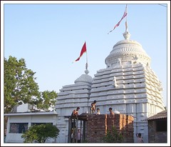
Kharagpur is a university town of 200,000 people located in the Midnapore West District of the State of West Bengal.

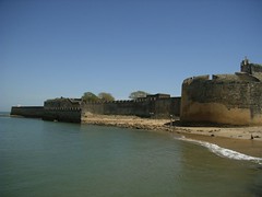
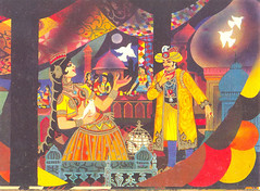
On 16th September 1931, freedom fighters in Hijli Jail were rejoicing the killing of Sessions Judge Mr Garley, who had passed death penalty to the famous freedom fighter Shri Dinesh Gupta. The jail authorities could not bear this and killed the freedom fighters in their cell. Today the infamous Hijli Jail is located inside the IIT campus area. Not to forget that The Father of the Nation, Mahatma Gandhi, also served his term in the Hijli Jail along with Khudiram Bose, one of the eminent freedom fighters of Bengal.

The first railway establishment at Kharagpur started with the commissioning of the rail link between Cuttack – Balasore - Kharagpur and from Sini to Kolaghat via Kharagpur. Kharagpur, as a junction station, was established in the railway map in December of 1898. It is said that the people were initially afraid to travel by train for fear of an accident over the bridge (fear of collapsing of bridge), fear of getting outcaste since there were no separate seating arrangements for different castes and religions. However, things changed in the face of famine during the early 20th century. The Railway Company came forward and offered jobs to the local unemployed men, gave them free train rides and even offered blankets for traveling by train. This promotional scheme broke the jinx and made rail transport acceptable to the society. Innovative marketing strategy!

Midnapur, the District Headquarters got connected (up to the bank of Kosai river) in February 1900. Construction of a bridge over Kosai was completed in June 1901. The rail line from Howrah to Kolaghat up to the eastern bank and from Kharagpur up to western bank of Rupnarayan river was completed in 1899. However, running of trains between Howrah and Kharagpur could only be possible in April 1900 after the bridge over Rupnarayan river was completed.

Howrah – Amta light railway (2 ft gauge) line was completed in 1898 and was operated by Martin & Co. of Calcutta. This link remained operative till 1971. After closure of the light railways, demand for a broad gauge line between Howrah and Amta creeped up. The project was completed in four phases. In the first phase, a line between Santragachi and Domjur was completed in 1984. In the 2nd phase it was extended up to Bargachia in 1985. Extension up to Mushirhat (Mahendralal Nagar station) was completed in 2000 and the final lap up to Amta was completed in December 2004.

The need for rail link between Panskura and Tamluk was conceived at the beginning of the 20th century, almost at the same time when the rail link between Howrah and Kharagpur was opened. The Railway Company received offers for construction from two Agencies, Martin & Company and Babu Nibaran Chandra Dutta. The former against guaranteed return of 3.5% while the latter without any guarantees. Although the offer of the latter was lucrative, the dilemma of whether to offer the work of construction to a native forced the project to be abandoned. After Independence, the requirement of rail link connecting Panskura and Durgachak came up primarily for the purpose of constructing Haldia Port. The rail link between Panskura – Durgachak via Tamluk was completed in 1968, which was later extended to Haldia in 1975. Extension of rail link to Digha from Tamluk was sanctioned in 1984 and it took 20 years to complete this project in two phases, the first phase of linking Tamluk and Kanthi completed in November 2003 and the tourist destination Digha got connected to Howrah/Shalimar in December 2004.

Geographical location of Kharagpur and its rail links with the rest of the country favored construction of centralized workshop with facilities to carry out major repairs of all broad gauge stock. In 1900, the work was sanctioned and the construction of the workshop completed in 1904.

Kharagpur railway station has the longest platform in the world. It is 3,517 feet long or more than a km long. It is the most important station of the South Eastern Railway.

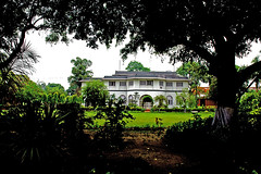
Indian Institute of Technology- Kharagpur, the oldest among the IITs, was formally inaugurated on August 18, 1951 by Maulana Abul Kalam Azad. Kharagpur was chosen as the location of the first campus of the prestigious Indian Institute of Technology. The IITs are the premier technical educational institutes in India and are internationally recognized for their academic and technical excellence. Unlike otherIndian Institute of Technologies, IIT Kharagpur has been long known for its ability to offer unusual courses not offered in other IITs.

Howrah, West Bengal


Howrah - the City of Joy?
Originally uploaded by seaview99.
Howrah is an industrial city and the second largest city in the State of West Bengal. Located on the west bank of Hoogli River, it is Kolkata's twin city.

It was back in 1713, The Bengal Council of British East India Company decided to lease five villages in this region from Farroq Shah (the grand son of Aurengzeb). Among those 5 villages, "Howbra" was the largest one and in 1714 the lease agreement was concluded and the British East India Company marked this entire area as "Howrah" .

Today, Howrah is famous for Howrah Station, the terminus for trains to all parts of India and the traffic jams across the Howrah Bridge encountered enroute to catching the trains.

It is a city where people are extremely talented with skills like machining, tailoring and confectionary & jewellery crafts. Most intricate machine tools and precision jobs for companies like Siemens, ABB, Bofors etc are carried out here.

Hugli-Chinsurs, West Bengal


IMAG068
Originally uploaded by am.a.goodman.
Located on the banks of Hooghly River, Hugli-Chinsura is a small town in the State of West Bengal, India. Hugli-Chinsura was a municipality formed by the merging of two towns, Hugli and Chinsura in 1865.

The Dutch erected a factory on the site in 1656 on a healthy spot of ground, much preferable to that on which Kolkata is situated. At that point Kolkata was the principal Dutch settlement in Bengal (although not known by the name). In 1759 a British force under Colonel Forde was attacked by the garrison of Chinsura on its march to Chandernagore, but in less than half an hour the Dutch were entirely routed. In 1795, during the Napoleonic wars, the settlement was occupied by a British garrison. During the peace of 1814 it was restored to the Dutch. It was among the cessions in India made by the King of the Netherlands in 1825 in exchange for the British possessions in Sumatra.

Darjeeling, West Bengal


Mayfair Hotel, Darjeeling
Originally uploaded by prolix6x.
The British East India Company converted Darjeeling into a hill station in the Shiwalik Hills at the height of 2,000 meters above the sea level, in 1800s. Once ruled by the Sikkim kingdom, this district was merged into the state of West Bengal.

Darjeeling is famous for its finest blends of tea around the world. It is a popular tourist destination.