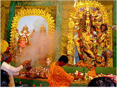
Durgapur, West Bengal
Two mighty rivers border it on the north and south. The Ajay River flows in the north and the Damodar River on the south. Even when coal mining made forays into the adjoining Asansol-Ranigunj area from the late eighteenth century, and factory chimneys reared their heads in the sky somewhat later, Durgapur remained an impenetrable jungle that few dared to trespass into.
In the mid nineteenth century, the railway track traversed the Durgapur area but even fairly recent pre-independence travellers describe Durgapur as a small station, with dim kerosene lanterns burning at night, where only a few passenger trains stopped.
Durgapur is located in the district of Burdwan, in the State of West Bengal, India, 168 km to the north of Kolkata. It is a well-planned industrial city on the banks of the river Damodar, with a population of about 250,000.


0 Comments:
Post a Comment
<< Home