Wednesday, January 31, 2007

Sariska National Park, Sariska, Alwar District, Rajasthan, India


Sariska National Park is located 35 kms from Alwar City, along the lap of Aravalli Hills in the Alwar District of Rajasthan. Originally, it was the hunting reserve for the erstwhile State of Alwar. Sariska was declared a wildlife sanctuary in 1955 and became a tiger reserve under ‘Project Tiger’ in 1979. The Sariska Tiger Reserve was converted to a National Park in 1982 and now stretches over 866 sq kms with a core area of 497 sq km. The Park is located 107 km from Jaipur, the capital of Rajasthan.

The Sariska National Park includes some important archeological sites like the Neelkanth Mahadev Temple, Garh Rajor Temples and the Kankwadi Fort. In the medieval times, Aurangzeb, the Mughal Emperor imprisoned his brother Dara Shikoh in the Kankwadi Fort after the war for the throne ended between the Mughal brothers. Dara was defeated on June 8, 1658 AD by Aurangzeb at the battlefield of Samogarh, 13 kms from Agra.

The princely State of Alwar was founded by Pratap Singh Prabhakar Bahadur (1740-1791 AD), a Rajput of the Kachhawaha lineage in 1775 AD. His adopted son, Bakhtawar Singh (1791-1815 AD) signed a treaty with the British East India Company in 1803 AD. Like his father Pratap Singh, Bakhtawar Singh further consolidated the State of Alwar but his local administration was inefficient. The state borrowed a lot of money from outside as the finances were mismanaged.

The State of Alwar was heavily indebted when the next ruler Maha Rao Vinay Singh (1815-1857 AD) ascended the throne. The new ruler was firm and effective and successful in stabilizing the general administration. He took complete control of the law and order situation and established criminal courts. Vinay Singh started the collection of land revenues in cash instead of kind. He introduced the Muslim ministers in his administration from Delhi in 1838 AD.

Sheodan Singh (1857-1874 AD) was only 12 years old when Maha Rao Vinay Singh died in 1857 AD. His rule began under the influence of the Dewans of Delhi. The local Rajput nobles rebelled and slaughtered the representatives of the Dewans of Delhi and sacked the Muslim ministers. The British intervened and sent Captain Impey as a Political Agent to Alwar in 1858 AD.

Maha Rao Sheodan Singh assumed the formal rule in September 1863 AD, and the British agency was abolished. Once again the Dewans from Delhi entrenched themselves in the administration and provoked another uprising of the Rajputs. The British once again took control in 1867 AD. Mangal Singh (1874-1892 AD) was also a minor when he succeeded Sheodan Singh as the next ruler of the State of Alwar. The British Political Agent continued to rule on behalf of Mangal Singh till he assumed the title of Maha Rao in 1889 AD. Mangal Singh himself supervised the military forces.

Maha Rao Mangal Singh died in 1892 AD and was succeeded by his only son, Jai Singh (1892-1937 AD). Maha Rao Jai Singh was also a minor when he inherited the throne of Alwar. He was assisted by the British and a State Council. Jai Singh was a good administrator and he established twelve administrative units called Tahsils to be governed by a Tahsildar. His long rule of 45 years was followed by Tej Singh (1937-1971 AD).

Monday, January 29, 2007

Baran, Rajasthan, India


Sarthal Temple-2
Originally uploaded by sanmang-photo.
Baran town is carved out of Kota city and is situated further into the Hadoti Region of Rajasthan. The Region is less crowded and attracts tourists who like to wander through isolated areas and in the interiors one can chance upon a ruined temple here and an abandoned fortress there. There are wooded hills and valleys that provide shelter to a large variety of wildlife of Rajasthan.

Baran is a District of the State of Rajasthan in Western India. The town of Baran is the district headquarters.

The district has a population of a million people. It is bounded on the north and east by Madhya Pradesh State, on the south and southwest by Jhalawar District of Rajasthan, and on the west and northwest by Kota District of Rajasthan.

Before Indian independence in 1947, most of present-day Baran District was part of the princely State of Kota, although Shahabad Tehsil was a discontinuous portion of Jhalawar princely State, and Chhabra Tehsil was a discontinuous portion of Tonk princely State. After Indian independence, the rulers of the princely States acceded to the Government of India, and the present-day Baran District was made part of Kota District. Baran District was carved out of Kota District on April 10, 1991.

Sunday, January 28, 2007

Barmer, Rajasthan, India


Colourful mojeri's Barmer
Originally uploaded by strandloper.
The city of Barmer was founded by Bar Rao (Bahada Rao) in the 13th century, when it was named Bahadmer. Barmer district is located near the border with Pakistan, in Thar desert. Every year a cattle fair is held at Tilwara village situated on the banks of Luni River in Barmer district. The fair is held in March-April and goes on for a couple of weeks. This is the best time to visit Barmer.

Barmer is famous for its handicraft, carved wooden furniture and hand block printing industry.

Saturday, January 27, 2007

Bharatpur, Rajasthan, India


just like a canvas painting
Originally uploaded by Arpana.
Who has not heard of Bharatpur Bird Sanctuary in eastern Rajasthan? Keoladeo National Park is one of the finest bird sanctuary in the world. Every year the rare Siberian cranes come to spend the winter in the warmer climate of Bharatpur. It is a painter's dream come true.

Bharatpur was the premier Jat State in Rajasthan. Badan Singh built the fort and palaces of Deej in 1725. Seven years later, his son laid the foundation of the fort of Bharatpur. It was a formidable structure called Lohagarh Fort (Iron Fort) which lived up to its reputation.

Thursday, January 25, 2007

Bikaner, Rajasthan, India


I'm so beautiful
Originally uploaded by TylerYoga.
Roa Bikaji founded the city in 1486 in the midst of the desert in north-western Rajasthan. Bikaner was part of the larger Region called Jangladesh. The area was mainly inhabited by Jaats and their main transport being the camels.

Wednesday, January 24, 2007

Bundi, Rajasthan, India

The City of Bundi (Hadoti Region) was established around 1241 AD by the Hada Rajput Chief Rao Deva, or Deoraj, who captured the town from the Bhils and other tribals of the area. In the past, a tribe called Meena (notorious robbers) inhabited this region and Bundi derived its name from the tribe' chieftain's name - Bunda Meena. The State lies on the north-east of the River Chambal, in a wild and hilly tract, historically known as Hadoti.

The City of Kota was established as early as 1264 AD but was part of the Hadoti Region ruled by the ruler of Bundi. In 1579 AD, the ruler of Bundi, Rao Ratan Singh handed over the smaller principality of Kota to his son, Madho Singh. This arrangement continued till 1624 AD when Emperor Jahangir, the great Mughal ruler, partitioned Bundi and made Kota an independent State. Rao Madho Singh ascended the throne of Kota.

The State of Bundi, older and more picturesque than Kota, never recovered from this partition of Hadoti Region. Bundi suffers from an inferiority complex as Kota has developed into a major industrial area while Bundi still lives with its past glory. The mighty River Chambal divides the two Hada Kingdoms created by the descendents of the Rajput Chauhans of Ajmer.

This outstanding Palace, built during the 16th and 17th centuries, is on the side of the hill below the Fort. It is a classic Rajasthani architecture. Only part of the Palace is open to the public. The Palace is entered through the Hathi Pole (Elephant Gate) into a small courtyard. Hathi Pole was built by Raja Ratan Singh in 1620 AD. You then come to the Ratan Daulat, the Diwan-e-am (Hall of Public Audience), where there is a marble throne.

Adjacent to the fort and past the bazaar, a wooden gate leads to the beautiful Bundi Palace. The highlight of this palace is the beautiful murals that carry the spectators back into the time of Bundi royalty. The murals cover almost entire palace walls; however, all these areas are not open for public viewing barring the Chitrashala. For visiting other areas, special permission needs to be obtained from the secretary of the Maharaja of Bundi. Photography is not allowed otherwise Bundi palace, illuminated with lights during night, presents a glowing beauty to be captured on camera.

Bundi is known as the “City of Stepwells”. It has about fifty beautiful tanks and stepwells called “Baoris”. This one known as “Rani Ji Ki Baori” or “Queen’s Stepwell” is the best because of its architectural beauty. It was built in 1699 AD by Rani Nathawat Ji, the Queen of Rao Raja Anirudh Singh of Bundi (reigned from 1681 to 1695 AD) who distinguished himself in the Imperial Campaigns of Aurangzeb in the Deccan, in the seize of Bijapur and also saw service in Afghanistan. Baoris used to be the center of religious and social functions in those days. Rani Nathawat Ji is reputed to have built twenty such Baoris. This Baori was constructed during the reign of her son, Maharao Raja Budh Singh, who ruled Bundi from 1695 to 1729 AD.


Tuesday, January 23, 2007

Chittorgarh, Rajasthan, India


chittorgarh fort
Originally uploaded by Debashree Banerjee.
Chittor was part of the Mewar Kingdom ruled by the legendary Bappa Rawal of Sisodia Dynasty. In 1303, the Sultan of Delhi, Allauddin Khilji was smitten by the beauty of Rani Padmini and took her husband hostage to force her to come to him. The whole incident of eventual battle and subsequent Johar is one of the most recounted stories of the Indian history.

Monday, January 22, 2007

Churu, Rajasthan, India


Churu is a town in the desert Region of Rajasthan. It is famous for shifting sand dunes of Thar Desert and beautiful grand Havelis with marvelous fresco paintings namely Kanhaiya Lal Bagla ki Haveli, and Surana Haveli with hundreds of small windows is equally famous. It also has some fine Chhatries.

The Churu city was founded in 1620 by a Jaat chieftain called Churu. It was part of Jangladesh prior to annexation by Rathores. Churu was ruled by Thakur Maldeo, grandson of the famous Rao Kandhal and uncle of Rao Bika-Rathore Rajputs of Bikaner. In 1871 AD Churu fell to Bikaner. In this battle between the forces of Churu and Bikaner when all the copper & brass exhausted Churu, Thakur asked his womenfolk to part off their silver ornaments and with this metal, shells for the canons were made and used in the battle. The famous temple of Salasar Balaji is situated in this District.

Sunday, January 21, 2007

Dausa, Rajasthan, India


The Kachwaha Rajputs of Central India first moved into Rajasthan through Dausa, which was then ruled partly by the Chauhans and partly by the Birgoojur Rajputs. Dulhe Rai (also known as Tej Karan) the Kachwaha descendent of Gwalior, married the daughter of Ralhan, the Chauhan ruler of Ajmer. He received Dausa as dowry, which was part of the Dhundhar region of Rajasthan. The Meenas Kings were the early rulers of Dhundhar. In 1037 AD, Dulhe Rai annexed the land from the tribe of Meenas and made Dausa his capital. He further initiated the conquest of Khoh and other areas of the Birgoojur Rajputs. Dhundhar region includes the present districts of Jaipur, Dausa, Sawai Madhopur, Tonk and northern part of Karauli.

Such is the pedigree of a city called Dausa that one would expect this historic city to look something like Jaipur or Amber. After all, the Kachwahas ultimately moved their capital to Amber and then finally to Jaipur. What you see today is a sleepy little city where nobody has heard of Mataji ka Mandir, Pratap Vatika or even the Balaji Mahadev Temple.

The District of Dausa is basically known for the Chand Baori (step well) at Abhineri. The Baori has come into focus after the release of a popular film “Paheli”. The megastars like Shah Rukh Khan and Rani Mukherjee have created such awareness of this spectacular monument. Legend has it that the Baori was built by ghosts in one night. The sculptures surrounding the Baori are artistic and a marvel of excellence for their craftsmanship. This could be an enormous draw for the tourism business for the District of Dausa.

The city of Dausa has a Shiv Temple called Neel Kanth Mahadev Temple on top of a hill where a large stone Linga was found with only its top visible above the ground. The temple is located on the Aravalli mountain range and has quite a steep climb to the top. Unfortunately, before you approach the temple complex, you have to go through a sizable community of houses with small, narrow lanes leading up to the base of the temple and the 200 year old monument is totally unprotected. It is likely that you would come across some riff-raffs, even before you decide to make the climb. Mr. Sachin Pilot, the Lok Sabha member from Dausa can look into this predicament and make a contribution.

The other monument of consequence in the city of Dausa is the Dargah of Hazrat Khwaja Jamaluddin Shah Baba. Few in the city have heard about this Dargah and when you reach the shrine, the people in and around are very helpful and courteous. Unfortunately, the Khadims at the Dargah have no clue about the story of Hazrat Khwaja Jamaluddin Shah Baba. They all were either born or brought up within the Dargah complex. The Dargah itself is a modest monument, located in peaceful surroundings. Despite the unfortunate lack of knowledge, it is generally believed that nobody ever returns from there without getting one’s wishes fulfilled.

Saturday, January 20, 2007

Dholpur, Rajasthan, India


IMG_0329
Originally uploaded by Anjali & Nipun.
The present town of Dholpur, which dates from the 16th century, stands somewhat to the north of the site of the older town built in the 11th century by Raja Dholan (or Dhawal) Deo, a Tomara Rajput chieftain; it is named Dholdera or Dhawalpuri after him.

Dholpur is well known for its excellent sandstone.This red stone was used to build not just the local structures but also those of Delhi like the Red Fort. In fact, the architect of modern Delhi, Edward Lutyens, had a special liking for it.

Friday, January 19, 2007

Dungarpur, Rajasthan, India


Airaavat
Originally uploaded by Meanest Indian.
Established by Rawal Veer Singh in 1282, Dungarpur (the City of Hills) was one of the major cities of the Vagad Region. Veer Singh acquired this land from the Bhil chief Dungaria from whom the place got its name. Dungarpur district is the stronghold of the Bhils, a tribe whose history of occupancy in the Aravalli Range is said to date back to 4000 BC.

Dungarpur is a city in southern Rajasthan. The Mahi River runs along the western edge of the District, forming the boundary with Banswara District. The Som River, a tributary of the Mahi, runs along the northern edge of the District, largely forming the boundary with Udaipur District. The District is bounded on the east by the State of Gujarat.

Thursday, January 18, 2007

Ganganagar, Rajasthan, India


vijaystambh
Originally uploaded by thakurprashantsingh.
Ganganagar, also called Sri Ganganagar, is a city in Rajasthan State of western India. It is named after the Maharaja of Bikaner 'Maharaja Ganga Singh' who established it. It is said that the Maharaja wanted a city based on the design of Paris to be established and hence the map of the Old Ganganagar city will give you a glimpse of the map of Paris. It is a testimony to land tranformation: Desert land was converted to a lush green town credited to the efforts of the Maharaja who bought the Rajasthan canal which carries the excess waters of Punjab and Himachal Pradesh to the Region, making Ganganagar known as "the food basket of Rajasthan".

Wednesday, January 17, 2007

Hanumangarh, Rajasthan, India


abu road 2004
Originally uploaded by itsduhh.
'Hanumangarh' is a town in northern Rajasthan State in western India, located 300 km from Delhi. It is the administrative seat of Hanumangarh District. Hanumangarh was the Kingdom of 'Bhati' Rajputs and hence its earlier name was 'Bhatner'. Later it was named 'Shardulgarh' when Raja Shardul Singh won it. Since it was won on a tuesday, which is the ominous day for monkey-god Hanuman, it was rechristened as 'Hanumangarh' - the Fort of Hanuman Monkey-God. A 900 year old 'Bhatner' fort is situated in the middle of 'Hanumangarh Town', the description of which can be found in 'Aaine-Akbari'. A famous 'Bhadrakali temple' is situated near the town on the banks of Ghaggar river.

Tuesday, January 16, 2007

Jaipur, Rajasthan


Green and Golden Gate
Originally uploaded by lapidim.
The princely state of Jaipur was established by Dhula Rai in 1128. The city of Jaipur was founded in 1728 by Maharaja Sawai Jai Singh, the famous mathematician and astronomer. The ruling dynasty of Jaipur gave the Mughal Empire, some of their most distinguished generals. The most famous amongst them were Raja Man Singh I and Jai Singh I.

The city was built of pink stucco in imitation of sandstone and therefore it is popularly known as the Pink City. The population of Jaipur is more than 2.7 million people.

Monday, January 15, 2007

Jaisalmer Fort - Jaisalmer, Rajasthan


The honey-hued city of Jaisalmer was established in 1156 AD by the Bhatti Rajput chieftain, Rawal Jaisal. The Bhatti Rajputs are descendents of the Yaduvanshi (Yadavs) clan. Yadavs believe that they are the direct descendents of Lord Krishna, the legendary “Avtar” of the Mahabharat fame.

The Bhatti Rajputs were driven out of their homeland in Punjab by the Turk invaders. Legend has it that the king of Ghazni (Afghanistan), Shal Bahan was sacked by Mamnenez, the king of Khorasan. Shal Bahan established his new capital at Sialkot in United Punjab. One of his sons was Rao Bhati and his descendants came to be known as Bhattis.

Once the clan of Bhattis was sacked in Punjab, they moved southwards and found a refuge in the Indian desert of Rajasthan. This could be around the 8th century and Lodurva, located 16 km to the south-east of present Jaisalmer, became their capital. Deoraj a prominent prince of the Bhatti family became the real founder of the Jaisalmer dynasty and they adopted the title of Rawal.

Sunday, January 14, 2007

Jalore, Rajasthan, India

Jalore was ruled by the Paramara Rajputs till the Nadol Rajputs captured the Jalore Fort in 1181 AD. In medieval times, Jalore was known as Jabalipura. The town of Jalore was known as Suvarnagiri or the Golden Mount, on which the Fort stands. It was a flourishing town during the Paramara rule.

Jalore is famous for its Fort, built probably in the 10th century, by the Parmars. The precise year of construction of the Fort is not known, however, it is believed to be built between the 8th and the 10th centuries. It is one of the most famous Forts in the State that stands atop a perpendicular hill. The Fort has four gigantic gates but it is approachable only from one side, after a two-mile long serpentine ascent. The Fort is built on the lines of traditional Hindu architecture.

The Chauhan clan of Rajputs started their empire around the Sambhar Lake then gradually moved south and west towards Nadol. From there they moved to Jalore in 1181 AD under the leadership of Kirtipala, the youngest son of Alhana, the ruler of Nadol. Kirtipala is the founder of the Jalore line of Chauhans. His son Samarsimha succeeded him in 1182 AD. After him Udayasimha became the ruler. The rule of Udayasimha was a golden period in the history of Jalore. He was a powerful and able ruler. He ruled over a large area and captured back Nadol and Mandor from the Muslims. In 1228 AD, Iltutmish circled Jalore, however, Udayasimha offered stiff resistance. He successfully resisted the Muslim invasions of Mohammad Ghauri. Udayasimha's court was a great intellectual center and during his reign, Jalore reached the zenith of its glory.

Udayasimha was succeeded by Chachigadeva and Samantasimha respectively. After Samantasimha, his son Kanhad Dev Songara became the ruler of Jalore. During the reign of Kanhad Dev Songara, Jalore was attacked and destroyed in 1311 AD by Ala-ud-din Khilji, Sultan of Delhi. Kanhad Dev Songara and his son Viramdeo Songara died defending the Kingdom.

Jalore later became part of the Marwar Kingdom, ruled by the Rathore Rajputs. The Muslim rulers of Palanpur in Gujarat ruled Jalore in the 16th century, and it became part of the Mughal Empire after Emperor Akbar conquered Gujarat. It was restored to Marwar in 1704 AD and remained part of the Kingdom until the Indian Independence in 1947.


Saturday, January 13, 2007

Jhalawar,Rajasthan, India


The State of Jhalawar was officially created on 8th April, 1838, out of Kota territory. It was a result of a treaty between the English rulers, the United State of Kota and the State of Malwa. Zalim Singh became the ruler of the new Kingdom of Jhalawar. The City of Jhalawar was founded in 1791 AD by the then Dewan of Kota State, Jhala Zalim Singh.

The story of Jhalawar and its ruler Zalim Singh goes back much further. In 1766 AD, Guman Singh ascended the throne of Kota, but did not rule for long. He fell ill and on his death bed in 1771 AD, passed on the throne to his ten year old son Umed along with Zalim Singh, his brother-in-law, as Umed’s guardian. Zalim Singh was quick to seize control even while the titular `King’ ruled officially.

The main town of Jhalawar, also known as Patan or Jhalrapatan, was founded by Zalim Singh in 1796 by the side of an artificial lake. The walled Jhalrapatan is a Jhalawar suburb, and its name is derived from the town’s numerous temples and their bells. It is believed that Jhalrapatan originally had 108 temples built over a few centuries, but today the finest amongst them is the 11th century Surya Temple, similar to the Sun Temple in Konarak, Orissa.

The Gagron Fort, 12 km from Jhalawar was founded in the 7th century and fully completed in the 14th century. It is called a Jala Durg (protected by water) because the Fort is surrounded by waters of the Ahu and Kali Sindh rivers on three sides. On the fourth side there used to be a deep moat completing its defenses. The Fort is now in ruins.

Mughal Emperor Akbar, captured Gagron in 1561 AD and the Mughals held it until 1715 AD when it was gifted back to Bhim Singh, one of the descendents of the ruling Jhala Rajputs. This was possible only after the death of Aurangzeb in 1707 AD.

Friday, January 12, 2007

Jhunjhunu, Rajasthan


Shekhawati #10
Originally uploaded by foto_morgana.
Maharaja Sardul Singh Shekhawat of Shekhawat clan conquered the city in 1787 from Nawab Sadulla Khan. Jhunjhunu town was established in the memory of Jujhar Singh, the Jat chieftain of Nehra Gotra, who fought with Sardul Singh to capture the city.

The town is famous for frescos on grand Havelis, which are common in the Shekhawati region. The Shekhawati Marwaris are some of the most successful businessmen in India today.

Thursday, January 11, 2007

Jodhpur, Rajasthan


bluer after the rain
Originally uploaded by thebigdurian.
A Rathore Rajput chief, Rao Jodha founded the state of Marwar and Jodhpur in 1459. Initially, Mandore was the capital of Marwar. However, during the lifetime of Rao Jodha, Jodhpur served as the state capital.

The city is also known as the "Sun City" for the bright sunny weather all year around. For some reason the city is painted blue and you see the color as far as the eys can see.

Wednesday, January 10, 2007

Karauli, Rajasthan

Karauli was officially founded in 1348 AD by the Yaduvanshi Rajput, Raja Arjun Pal. This holy city was originally known as Kalyanpuri, after the local deity Kalyanji. Legend has it that the princely State of Karauli was established by Raja Bijal Pal Jadon, the 88th descendent of Lord Krishna, as far back as 995 AD. There is very little documentation available to support this theory. Little is known about the history of the State and the ruling family between 995 AD and 1348 AD.

The 600 year old Fort was built probably in the 14th century by the Royal family and a magnificent Palace in 1635 AD. The Fort and the Palace remained the official residence of the Royals till 1938 AD. At that time, a much more modest Bhanwar Vilas Palace was built by Maharaja Ganesh Pal Deo Bhadur, the then ruler of Karauli and the Fort was abandoned by the family. The property is now being managed by a Temple Trust.

Red sandstone ramparts surrounded the walled city with bastions for security. Today, these ramparts are in ruins but still boast of six gates and eleven posterns. Very little of the original structure remains. The present City Palace is the 18th century building with elaborate ornamented stucco work and frescoes. The Palace has a major rehabilitation work in progress, hopefully under professional supervision.

The ruling family members of Karauli are considered the descendents of Lord Krishna, the Yadav Rajputs. The city is the home of Shri Madan Mohanji, the deity of Lord Krishna, worshipped by millions of followers from Rajasthan and the rest of India. Kaila Devi is another important deity of Karauli with a temple dedicated to her. The Fair of Kaila Devi, popularly known as Mahalakshmi, (the Goddess of Wealth), holds an important place among the celebrated Fairs of Rajasthan. The fair is held at the village of Kaila in Karauli District in the month of Chaitra.


Tuesday, January 09, 2007

Kota, Rajasthan, India

The Hadas are Agnivanshi Rajputs and direct descendents of Manik Rao, the ancestor of the Chauhan clan. Rao Anuraj, a descendent of Manik Rao, was the progenitor of the Hada Clan. The Hada Chauhans were forced to flee Ajmer in the face of Muhammad Ghori’s feared invasion in 1192 AD. Hada Rao Deva conquered and founded Bundi State in 1241 AD and Kota in 1264 AD. The area covered by the State came to be known as “Hadauti,” a derivative of the word “Hada.”

The Hadoti region includes the present-day districts of Baran, Bundi, Kota, and Jhalawar. Hadoti is bounded on the west by the Mewar region of Rajasthan and on the south by the Malwa region of Madhya Pradesh State. Hadoti has a wealth of beautifully sculpted temples that seem frozen in time. Gods have been very kind to Hadoti region. They have blessed it with the mighty Chambal River and lots of water.

The City of Kota was founded in 1264 AD after Jaitsa, the third son of Samarsi of Bundi, killed an Ujala Bhil chieftain named Koteya, and then annexed his territories. The Kota State was created in 1579 AD when it broke away from the larger State of Bundi. It was during the reign of the Mughal Emperor Jahangir, that the ruler of Bundi, Rao Ratan Singh, gave the smaller principality of Kota to his son, Madho Singh.

Madho Singh, born in 1565 AD, the battle-hardened 14 year old Rajput, went to war against Aurangzeb in 1579 AD. The battle was fought on behalf on the Mughal Emperor, Shah Jahan. Rao Ratan Singh, the ruler of Bundi and the father of Rao Madho Singh, lost five of his six sons. Madho Singh survived the battle as a glorious hero. Shah Jahan was so fascinated by Madho Singh’s valor that he issued a Royal Farman (dictat) and bestowed the Kingdom of Kota upon him. When Rao Madho Singh died in 1651 AD at the age of 86, he left his expanded Kingdom to his five sons. Rao Mukund Singh, the eldest was made the chief of Kota by mutual consent.

Monday, January 08, 2007

Nagaur, Rajasthan


Nagaur Camel and Cattle Fair
Originally uploaded by Jungle_Boy.
Midway between Jodhpur and Bikaner, lies the city of Nagaur in the State of Rajasthan. The foundation of the city dates back to 4th century. Nagaur city was at the center of Muslim invasion from Central Asia. The saline Sambhar Lake, India's largest salt lake and Rajasthan's largest lake, lies at the southwestern corner of the district.

Nagaur with its massive ramparts and impressive gateways is one of the fascinating towns of Rajputs. The town was granted to Raja Amar Singh Rathore by the Mughal Emperor Shah Jahan.

Nagaur is the venue of an annual cattle fair held in Jan/Feb. During the four day festival, the town is thronged by cows, bullocks, oxen and camels accompanied by turbaned sellers and eager buyers.

Sunday, January 07, 2007

Pali, Rajasthan


raika 3
Originally uploaded by spackle.
Situated on the banks of Bandi River, Pali is a town in the State of Rajasthan. Pali District has a population of 1.8 million people and rapidly growing.

The Rathore family chronicles relate that Siyaji or Sheoji, grandson of Jai Chandra, the last Gahadvala Rathore King of Kannauj, came to Marwar on a pilgrimage to Dwarka in Gujarat, and on halting at the town of Pali he and his followers settled there to protect the Brahmin community from the raids of marauding bands. His devali with the inscription of 1273 AD was discovered at 21 km north west of Pali. Champavatas Rathores ruled Pali until 1761 AD when it became part of Jodhpur state.

Rao Chanda, tenth in succession from Siyaji, finally wrested control of Marwar from the Pratiharas. His son and successor, Rao Jodha, moved the capital to the city of Jodhpur, which he founded in 1459. Pali remained a part of the Marwar kingdom until 1949, when the last ruling Maharaja acceded to newly-independent India.

The temple of Somanatha situated here is the oldest in the town.

Saturday, January 06, 2007

Rajsamand, Rajasthan


flying out in unison
Originally uploaded by prakhar.
The city and the district are named for Rajsamand Lake, an artificial lake created in the 17th century by Rana Raj Singh of Mewar. Rajsamand District is part of the Mewar Region, and was historically part of the Kingdom of Mewar. The District has a population of over a million people.

Friday, January 05, 2007

Sawai Madhopur, Rajasthan

The city of Sawai Madhopur was established in 1765 AD by Sawai Madho Singh-I of Jaipur. Located in the eastern part of Rajasthan, Sawai Madhopur was built as a planned city. During this period, the Maratha rulers of Western India were gradually increasing their influence in this region. In order to check the incursions of the Marathas, Sawai Madho Singh-I fortified the village of Sherpur in 1763 AD. This was the genesis of the city of Sawai Madhopur which was only about 180 kms to the north-east of Jaipur, along the hills of Vindhyas and the Aravalli ranges.

Sawai Madhopur has a rich history preceding the construction of the city. Madho Singh was the second son of Maharaja Sawai Jai Singh II, the founder of the city of Jaipur. Madho Singh was born in 1728 AD, 20 years after the marriage of Jai Singh II and Maharani Chandra, the princess of Sisodias (Mewar). The matrimonial alliance with Mewar was established on the condition that Princess Chandra’s son would inherit the throne of the Kachwaha (Jaipur) Kingdom. The succession was denied to Madho Singh and his older step-brother, Ishwar Singh was installed after the death of Maharaja Sawai Jai Singh in 1743 AD.

The new Maharaja was not acceptable to Madho Singh at all. Udaipur (Sisodias) sent their forces to Jaipur almost immediately, demanding the coronation of the rightful successor. Sawai Ishwari Singh resisted the pressure and fought his step-brother, Madho Singh, for seven long years. The rebellion continued and Madho Singh was joined by not only Udaipur but also the Marathas. The Kingdoms of Bundi and Kota also joined the struggle to depose Ishwari Singh. The 29 years old monarch was betrayed by his own Prime Minister and Commander-in-Chief, Hargovind Natani. Sawai Ishwari Singh decided not to fight till death instead committed suicide in 1750 AD and ended the struggle for succession.

The oldest monument in Sawai Madhopur District is the Ranthambore Fort, built in 944 AD by the Chauhan Rajput King Sapaldaksha. The Fort is located 700 feet above the surrounding area and commanded a strategic location. After the defeat of Prithviraj Chauhan at the hands of Muhammad Ghori in 1192 AD, Govinda, the grandson of Prithviraj established himself at Ranthambore. Govinda Raja was succeeded by his son Balhana. The Fort had its golden period from 1282 AD till 1301 AD, during the reign of Rao Hammir, the last ruler of the Chauhan dynasty.

Alauddin Khilji, the ruler of Delhi, conquered the Ranthambore Fort in 1301 AD, after three unsuccessful attempts. For the next three centuries, the Fort changed hands a number of times. Finally the Mughal Emperor Akbar took over the Ranthambore Fort and dissolved the Vassal State of Ranthambore in 1558 AD. The Fortress was restored to the Kachwahas (Maharaja Sawai Madho Singh-I of Jaipur) by the Mughals (Emperor Shah Alam) in 1765 AD and it remained part of Jaipur State until the Independence of India in 1947 AD.

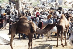
During the 18th century, the forests of Ranthambore were the private and exclusive hunting reserves of Sawai Madho Singh-I of Jaipur. These forests are located at the confluence of the Aravalli Hills and the Vindhyas mountain range. The erstwhile rulers of Jaipur felt the need to preserve the area. This world famous wildlife reserve was established in 1955 AD and was called Sawai Madhopur Wildlife Sanctuary. The Maharaja of Jaipur was permitted to hunt in the Sanctuary till 1970 AD, after that hunting was banned completely. The Sanctuary, covering an area of 392 sq km, was included in the Project Tiger in 1973 AD. Sawai Madhopur Wildlife Sanctuary, Ranthambore, attained the status of a National Park in 1980 AD.


Thursday, January 04, 2007

Sikar, Rajasthan


India05_202
Originally uploaded by nzwarner.
Sikar is located in the Shekhawati region of Rajasthan. This village was founded by Veerbhan Jat. Sikar was known as 'Veerbhan-ka-baas' in ancient times and it was under the rule of Nawab of Fatehpur, Shekhawati. The fresco paintings of grand havelis of Sikar are a peculiarity of Shekhawati.

Wednesday, January 03, 2007

Mount Abu, Sirohi, Rajasthan

Rao Sahasmal established the town of Sirohi in 1425 AD. He was the direct descendent of the Deora-Chauhan dynasty that brought the end of the Parmars’ rule over this region. Dhumraja established the Parmar dynasty in 961 AD, over the area known as Arbudha, which included the present day District of Sirohi. Rao Lumba seized Mount Abu from the Parmar King in 1311 AD and established the Kingdom of Sirohi. Lumba ruled Sirohi till 1320 AD with Chandravati as the Capital of Sirohi Kingdom.

Rao Shiv Bhan popularly called ‘Sobha’, the sixth descendent of Rao Lumba, abandoned Chandravati and founded the new Capital, called Shivpuri in 1405 AD. Rao Sahasmal was the son of Rao Sobha Ji. Sahasmal also laid the foundation of the Sirohi Fort in 1425 AD. He moved his Capital from Shivpuri to Sirohi. Shivpuri today lies in ruins.

During the reign of Rao Sahasmal, Rana Kumbha of Mewar attacked and conquered Mount Abu. Rana Kumbha established the Fort of Achalgarh in the year 1452 AD. Rao Lakha succeeded Rao Sahasmal as the ruler of Sirohi and tried to liberate Mount Abu with the help of Qutbuddin Ahmed Shah II, the King of Gujarat. Lakha failed to get his territory back. His son, Rao Jagmal finally married into Sisodias and got back Mount Abu in 1457AD.

The cozy relationship with Udaipur (Sisodias) ended after the death of Maharao Man Singhji II in 1572 AD. The death of the ruler of Sirohi and his son thereafter, resulted in a power vacuum. The chosen successor, Maharao Surtan (1572 AD – 1610 AD, was not acceptable by some of his own clansmen. By the time Surtan died, he had fought fifty two battles and lost each and every one. The next two hundred years saw Sirohi largely in decline.

In 1808 AD, Maharaja Man Singh of Jodhpur seized the ruler of Sirohi, Maharao Udai Bhan, while he was returning home after his father’s funeral. Jodhpur demanded a huge ransom in exchange for Maharao’s return. The ransom was paid and that meant raising taxes on the population. This strange incident crippled the economy of Sirohi Kingdom. The nobles rebelled against Udai Bhan and appointed his younger brother, Sheo Singh, to assume the reigns of the government in 1817 AD. The British had arrived by then. Maharao Sheo Singh ruled till 1846 AD under their protection.


Tuesday, January 02, 2007

Tonk, Rajasthan


Originally uploaded by PhotoSchmuck.
Situated near the right Bank of Banas River, Tonk is a small town in the State of Rajasthan. Also known as the "Lucknow of Rajasthan", Tonk is a very elegant little town in Rajasthan. It is famous for its colorful mosques, mansions and havelis. Spend a holiday in this beautiful little place, which boasts of a rich cultural and traditional heritage.

A holiday package to Tonk almost always includes a tour of the Golden mansion or the Sunehri Kothi. It is a beautiful little Palace that is adorned with mother-of-pearl and many kinds of precious stones.

Monday, January 01, 2007

Udaipur, Rajasthan


Glass Peacock
Originally uploaded by doc18.
Located at the foothills of the Aravalli Range mountains, Udaipur is the historic capital of the former kingdom of Mewar. Rana Udai Singh II of Chittor established the city of Udaipur in 1568. The kingdom of Mewar was ruled by the Rajput clan of Ranawats and Sisodias. Chittorgarh was the ancient capital of Mewar but once the Mughal emperor Akbar captured Chittor, the Rajput Rana Udai Singh moved the capital to the site of his residence. With the decline of Mughal empire, the Sisodias reasserted their independence and recaptured Chittor, but Udaipur remained the capital of the state.